LAST UPDATED: 2/27/26 – Zion National Park Guide
Zion National Park might be the biggest adventure park of all the national parks in the continental United States. The park is absolutely filled with big adventures of all kinds. The park has some of the most extreme hikes and extreme views of any park in the lower 48 states. This is what attracts millions of visitors a year to Zion Canyon ,and it’s what keeps them coming back again and again.

Zion is a Park with Iconic Hiking Trails
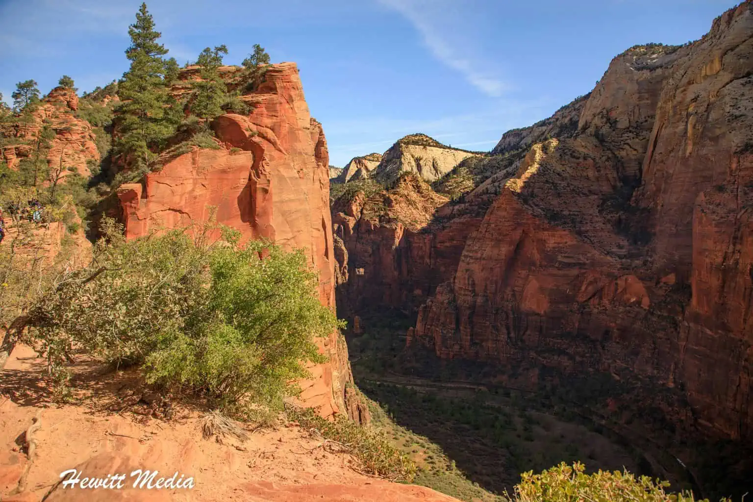
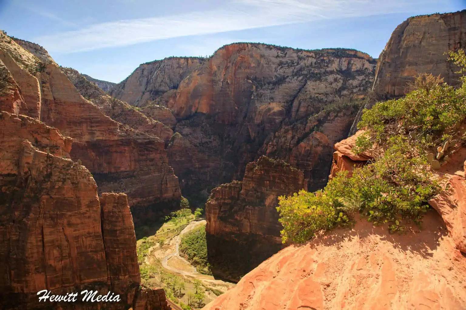
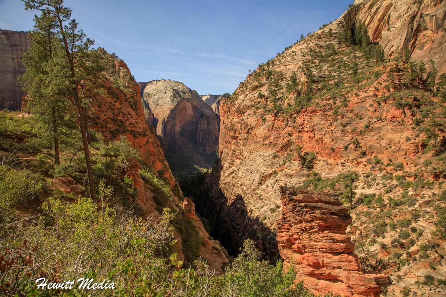
The Park hosts two of the American Southwest’s, if not the continental United States, most epic hikes. The Angel’s Landing hike is considered to be one of the most difficult hikes in the US national park system and has some of the park system’s prettiest vistas as well. People from all over the world come to Zion to conquer the Angel’s Landing hike and explore the slot canyons of Zion on the Narrows hike.
The Narrows hike is one of the most unique and gorgeous hikes in the entire park system. Hiking up the North Fork of the Virgin River, the Narrows hike takes you in between the narrow slots carved by the river and through some of the most beautiful scenery in the American Southwest. It is truly a one-of-a-kind hike.
In addition to these infamous hikes, Zion National Park offers a lot for outdoor enthusiasts of all kinds. It has some of the best rock-climbing spots in the world, plenty of wildlife viewing opportunities, some absolutely breathtaking vistas, and miles of amazing hiking paths. In this Zion National Park guide, I am going to show you how to see it all.
Zion National Park Guide Navigation Menu

How to Get to Zion National Park

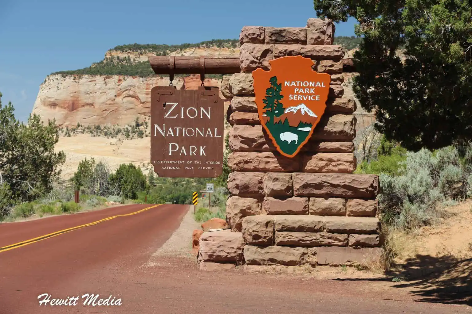
Zion National Park is located in the far Southwest corner of the state of Utah, near the cities of St. George and Cedar City. If you are in the Las Vegas area, Zion National Park is only a 2-hour and 45-minute drive North of Las Vegas. This makes it a very attractive side excursion for any Las Vegas vacation.

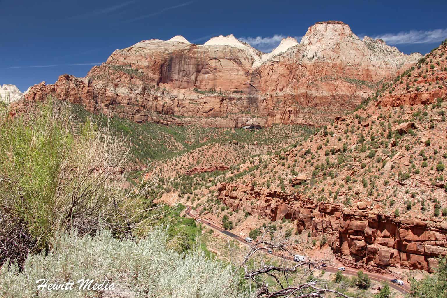
Zion National Park rests within Zion Canyon, which was carved out by the Virgin River over millions of years. There are two ways into the canyon: via the South Entrance near Springdale, Utah, or via the Zion-Mount Carmel highway and tunnel.
Cars are Generally Not Allowed in the Park
Because of the limited roadways inside Zion National Park and the large numbers of annual visitors, cars are not generally allowed within the park for most of the year. Instead, shuttles take you from the visitor center at the South Entrance all the way to the end of the park and back. I cover these shuttles in more detail later in this guide.
One way that you can arrange to bring your car into the park is to either stay at the Zion Lodge, which lies within the park, or to make a reservation at the lodge’s restaurant, the Red Rock Grill. In either case, you will be given a pass at the entrance gate to bring your car into the park.
That said, the shuttle service is extremely efficient and significantly reduces the congestion within the park, so I would strongly recommend that you make use of it. The shuttles run very frequently and take you to all of the important launching spots for the park’s many hikes and other activities. For an overview of the park, please see the map I included in my Zion National Park guide below.

When to Visit Zion National Park

Zion National Park is open year-round, but depending on what you are planning to do when you visit, some months of the year may be better than others. For instance, the summer months are much warmer, yet much more crowded, than the spring, fall, or winter months are. If you don’t like hot weather, then you might want to avoid visiting during the summer.
If you are planning on doing some hiking, I would recommend the months of April and October. These months aren’t as hot or as crowded as the summer months, but are also much drier than the winter and early spring months.
You are going to want to make sure you avoid the big crowds if you are going to do the Angel’s Landing hike, as it is much safer when it is less crowded. If you are planning on doing the Narrows hike, then you are absolutely going to want to avoid the cold months and the rainy months, as the water can be pretty cold, and flash floods can be dangerous.
Average Temperature (°F)
As you can see in the chart I included in my Zion National Park guide below, the summer months can be quite hot in the park, while the low temperatures in the winter months can get below freezing. Make sure you prepare and dress appropriately when you visit.
Average Precipitation (Inches)
Zion National Park can be quite dangerous when it rains (even rain up to 25 miles away can lead to flash flooding within the park), so planning your trip for the drier months is always a good strategy. The chart I included in my Zion National Park guide below lists the average amount of precipitation per month that the park gets throughout the year.
Average Number of Visitors
Zion National Park is the 5th most visited National Park in the United States, with over 3 million visitors a year going through its gates. You are going to want to make sure you strategically plan to miss the largest crowds, as the most popular trails can get quite congested during peak season. The chart I included in my Zion National Park guide below gives you a look at the average number of visitors throughout the year.
Zion National Park Resources
The key to any great trip is great preparation. To assist you in preparing for your trip to Zion National Park, I have included some key resources for you to review in my Zion National Park guide below. Everything from maps to food and lodging to gear rental is covered in these resources.
Zion National Park Map

Download Zoomable PDF Park Map
Other Park Resources
- Zion National Park – Hiking in Zion
- Zion National Park – Plan Your Visit
- Zion National Park – Things to Do
- Zion National Park – Wildlife
- Nearby Attractions
- Springdale Visitor’s Guide
- Zion Adventure Company
Zion Shuttle Service

Between March and late November, Zion Canyon is only accessible via shuttle. The shuttle service was implemented in the year 2000 to try to alleviate some of the overcrowding within Zion Canyon. So far, the shuttle service has been a huge success.
Make Sure You Arrive at the Park Early
If you plan on visiting Zion National Park, I would strongly suggest you plan on arriving early in the morning. Parking at the visitor center tends to fill up by mid-morning, so you will want to make sure you are there to grab a parking space. I suggest monitoring the X account for Zion National Park to keep tabs on the parking situation. They do a great job of letting the public know when parking is full.

If parking at the visitor center does fill up on the day you visit, all is not lost. There is additional parking in the town of Springdale, with regular buses that bring you to the park. From there, you can catch a shuttle that will take you into the park.
The shuttle service starts at the visitor center and makes eight stops within the park. The last stop is the Temple of Sinawava, which is where you get off to do the Narrows hike. The whole route takes roughly 40 minutes from the visitor center to the Temple of Sinawava, so make sure you plan your time accordingly.

Check the Shuttle Schedule Before Arriving
Before you arrive at the park, make sure you check the current shuttle schedule for Zion National Park. It is important to understand the schedule for the current season. The shuttles do not run at the same times all year, so you will want to know when the shuttles start and stop when you will be visiting.
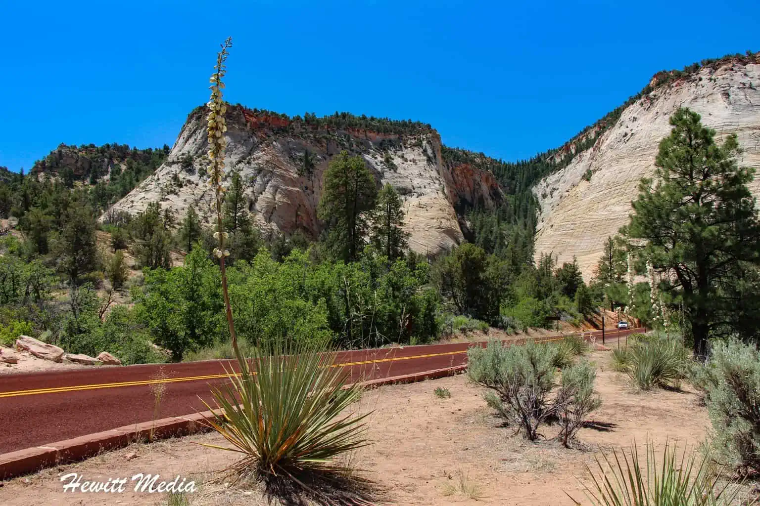
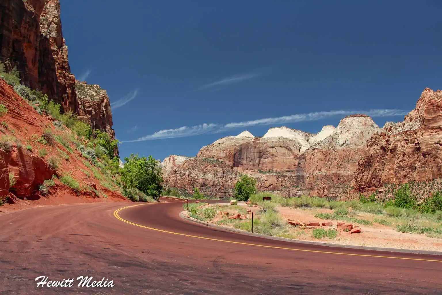
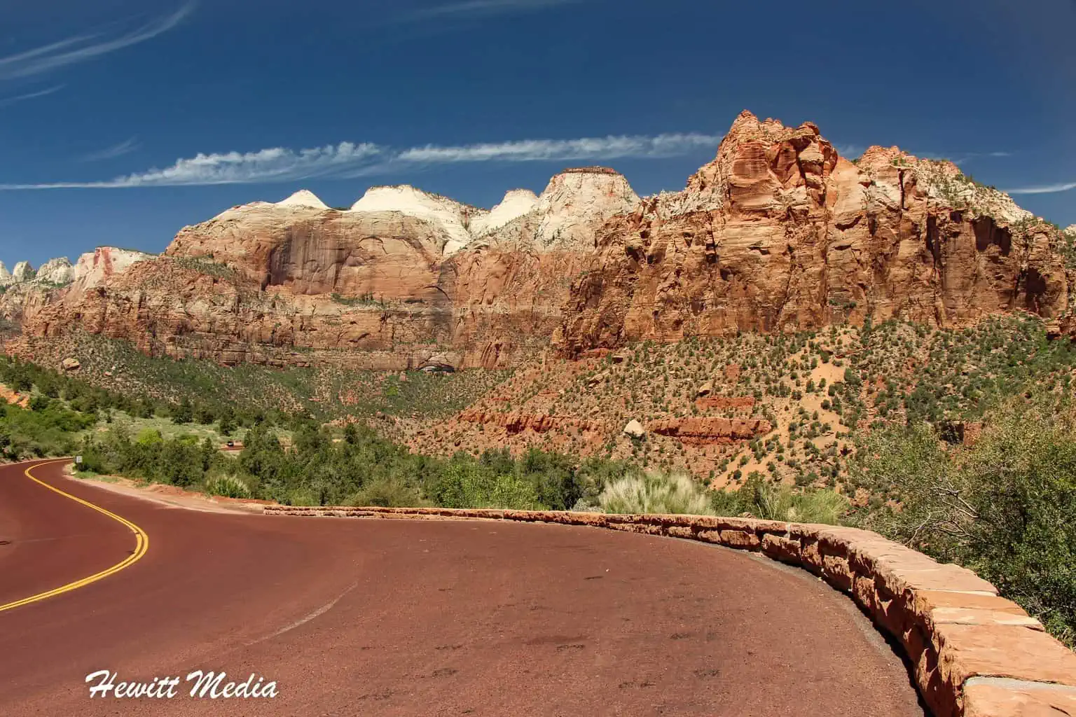
Top Things to See and Do in Zion National Park
There is a wealth of things to do in Zion National Park, which is why it is one of the most popular parks in the United States. It is home to some of the most challenging and beautiful hikes in North America, as well as some of the best rock climbing spots in the entire world.
Whether you are interested in challenging yourself on the park’s hiking trails or just looking to gaze at the stunningly beautiful landscape, Zion National Park has something for everyone. To help you plan, I included suggestions on what to see in my Zion National Park guide below.
| RELATED READ: | |
 |
|
| Best Hikes in America’s National Parks System |
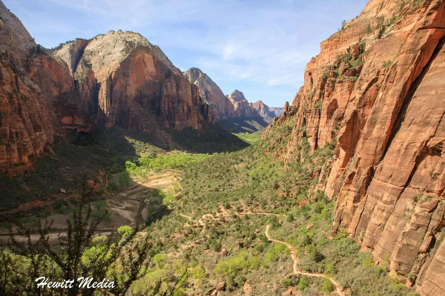
Angel’s Landing Hike

If you have read our list of the Top Hikes in the National Parks System, then you are probably already familiar with Angel’s Landing, as it was the number one-ranked hike on our list. This is, without a doubt, one of the most challenging hikes in the entire park system. It is classified as strenuous and can be extremely dangerous if you aren’t prepared and know what you are doing. In other words, this hike is not for everyone.
| Angels Landing Trail Stats | |
|---|---|
| Trail Type: | Out-and-Back |
| Distance: | 4.7 miles/7.6 kilometers |
| Elevation Gain: | 1,738 feet/530 meters |
| Time to Complete: | 3 to 5 hours |
| Difficulty Level: | Strenuous |
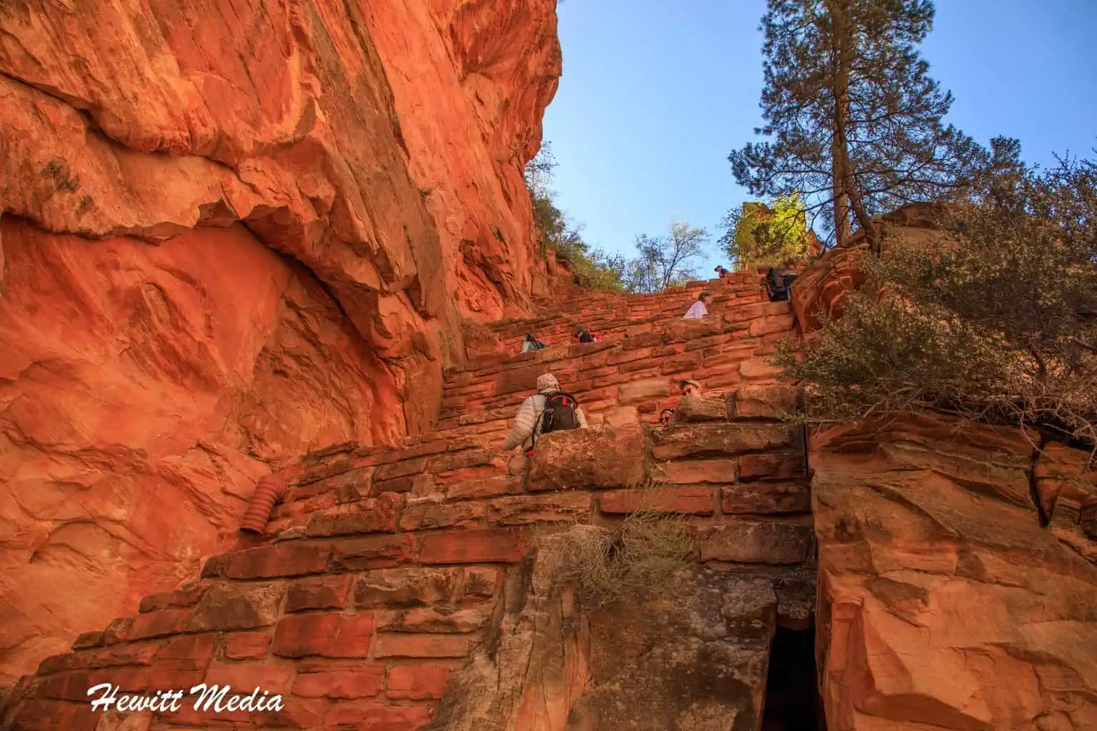
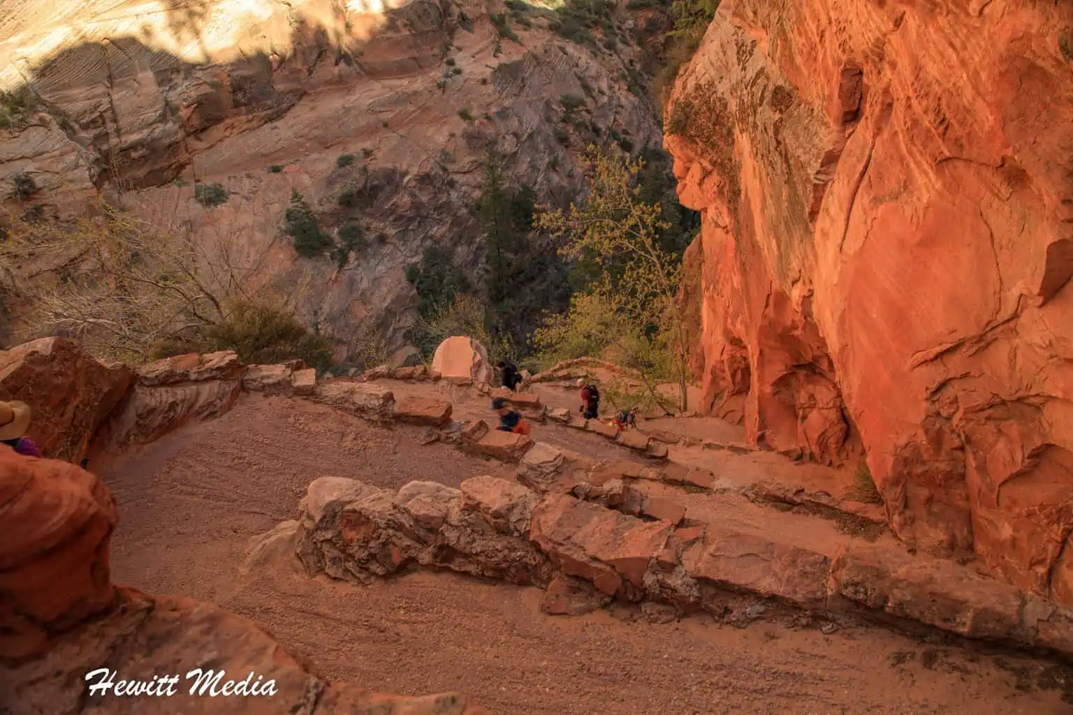
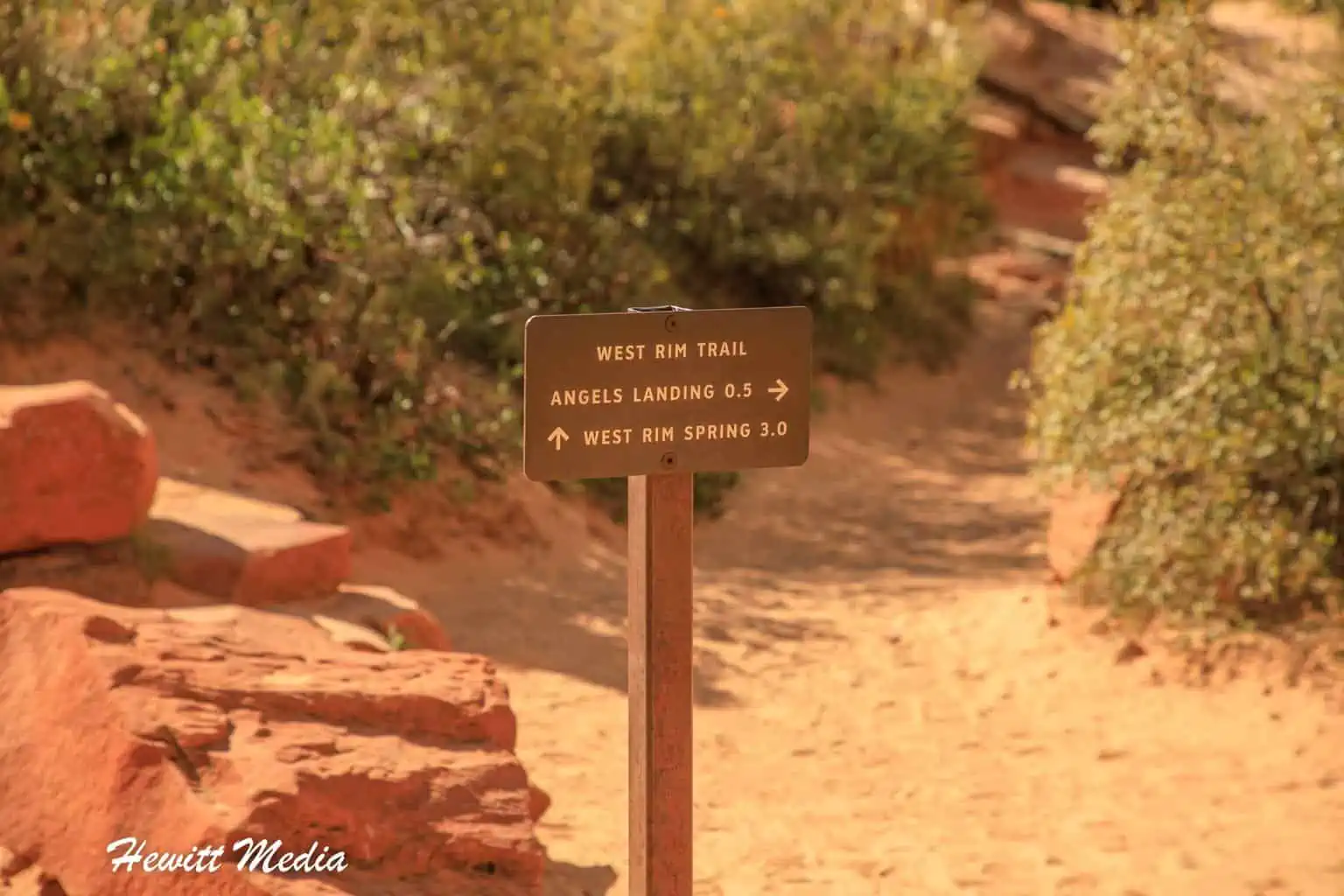
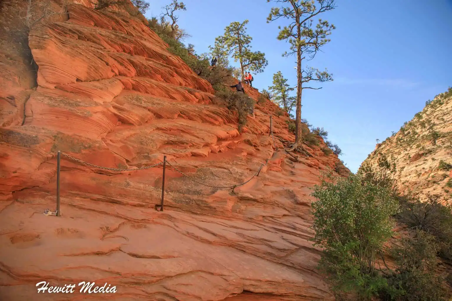
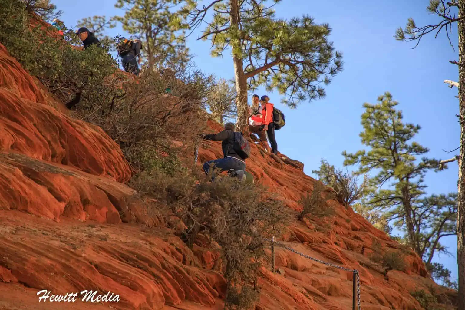
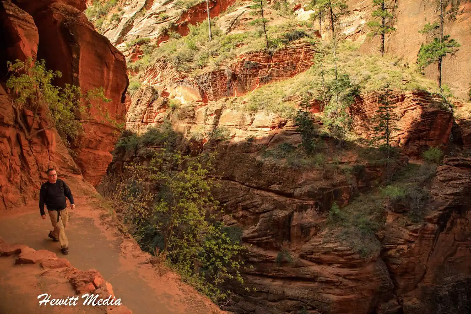
The Angel’s Landing hike is only a half-mile out and back (you do need to hike the West Rim Trail for 2 miles to get to the Angel’s Landing trailhead), but it is mostly a rock scramble over a knife ridge that is over 1,500 feet above the canyon floor.
There are certain spots on this trail where there is no room for error. One slip, and you are dead. The park service has installed some chains along the trail to make it safer, but the chains are mainly intended to guide you along the trail. The Angel’s Landing hike still averages around one death per year, which makes it one of the most dangerous hikes in the National Park System.
I completed this hike back in 2009, and have not attempted it again in the two times I have visited the park since. It is definitely a hike that you need to be 100% comfortable with before undertaking, and the few times I have been back to Zion since 2009 have been very crowded, and I did not feel like the trail was safe with so many people on it.
| Angels Landing Trail Map |
|---|
You Now Need a Permit
Because of the issues with overcrowding on the Angel’s Landing trail, the park service piloted a permit program starting in 2020. Now, you must apply for a permit before being allowed to hike the Angel’s Landing Trail. You can either obtain a permit through the seasonal lottery or the day-before lottery system (link above). Rangers check permits at the trailhead, so don’t try to hike Angel’s Landing without one.
Be Safe and Considerate

As I mentioned above, the Angel’s Landing hike is not for everyone. It is a very difficult hike that is almost more of a climb than it is a hike. Even though the National Park Service has installed safety chains along the trail, the trail is still incredibly difficult. If you are interested in hiking Angel’s Landing, please be aware of the following when assessing how safe it is to complete the hike.
Things to Consider Before Hiking Angel’s Landing
- Trail Conditions – This hike is difficult enough in the best of conditions. Do not attempt to complete this hike if the trail has ice on it or if the trail is still wet from recent rain. The rock can be incredibly slippery when wet or icy.
- Wind Conditions – Do not attempt to complete this hike if it is especially windy out. There is no room for error on this trail, and windy conditions can make this hike even more difficult.
- Crowds – Do not attempt to hike Angel’s Landing if there is a long line queued up at the beginning of the hike. The start of the Angel’s Landing trail isn’t that difficult, but these crowds will make the hike more treacherous during the more difficult scrambles that come later on down the trail. The trail has traffic going both ways, and it is really easy to get bumped accidentally. If you do decide to hike, make sure you ALWAYS practice proper trail etiquette. DO NOT be in a hurry, or you will endanger yourself or others.
- Gear – Do not attempt this hike if you do not have proper hiking boots (tennis shoes do not count as proper hiking boots). The rock along the trail can be extremely slippery, and one slip could mean death.
- Fear of Heights – Do not attempt to complete the Angel’s Landing hike if you have a fear of heights. There are 1,500-foot drops along this trail, and sometimes they are on both sides at once. In some spots, the trail you are scrambling on is only 5 feet wide with thousand-foot drops on both sides. This hike is not for those afraid of heights.
Accessing the Trail
To access the Angel’s Landing trail, you will want to take the Zion Shuttle to the Grotto stop. From the Grotto stop, you are going to want to take the West Rim trailhead, which is located on the opposite side of the street from the shuttle stop. The West Rim Trail will take you up to Scout Lookout, which is where the Angel’s Landing trailhead is located.
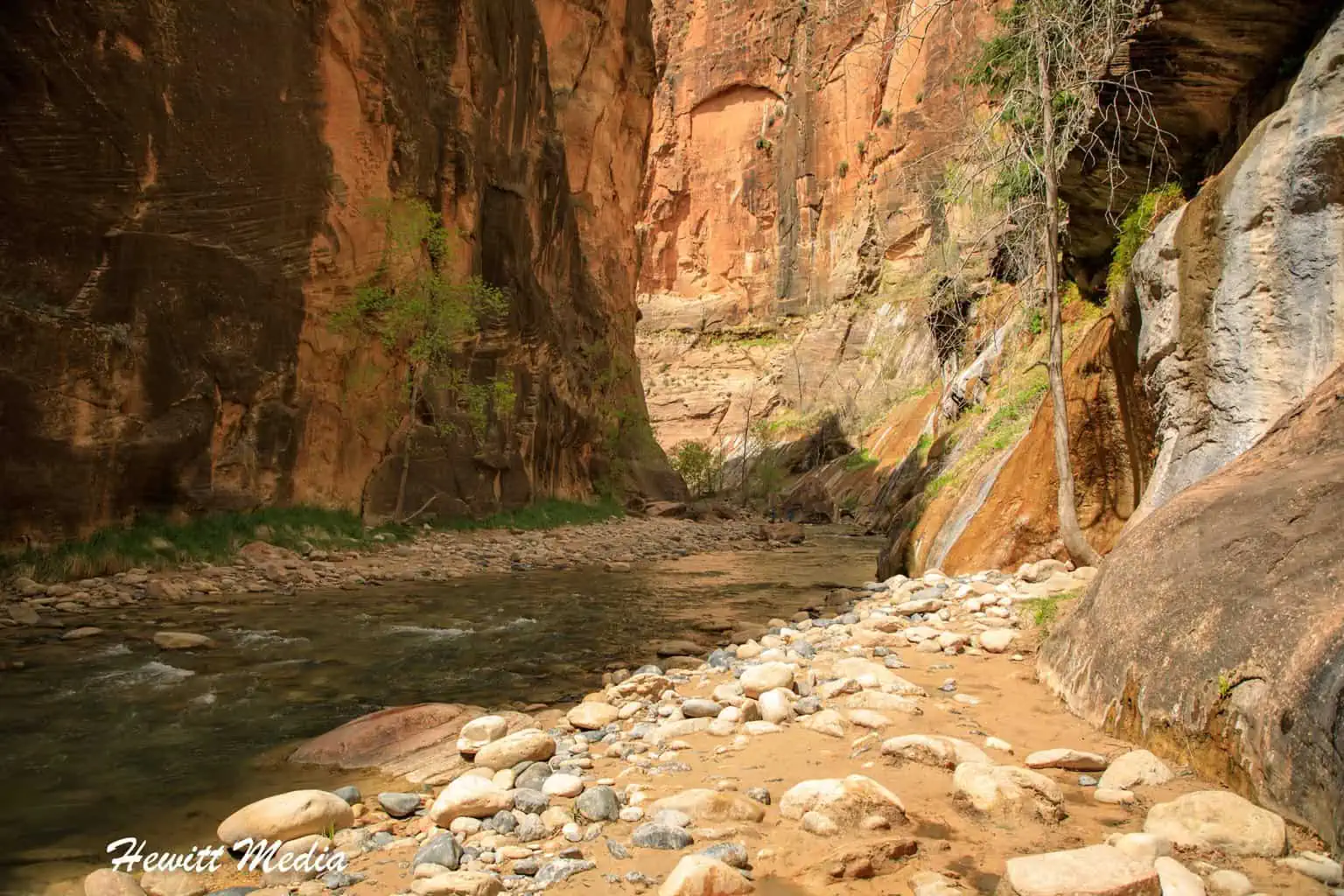
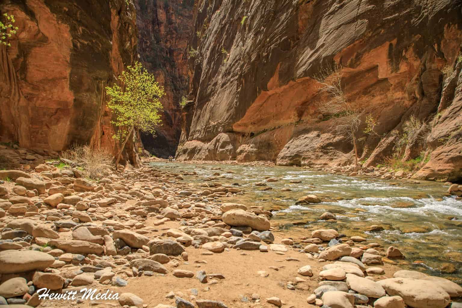
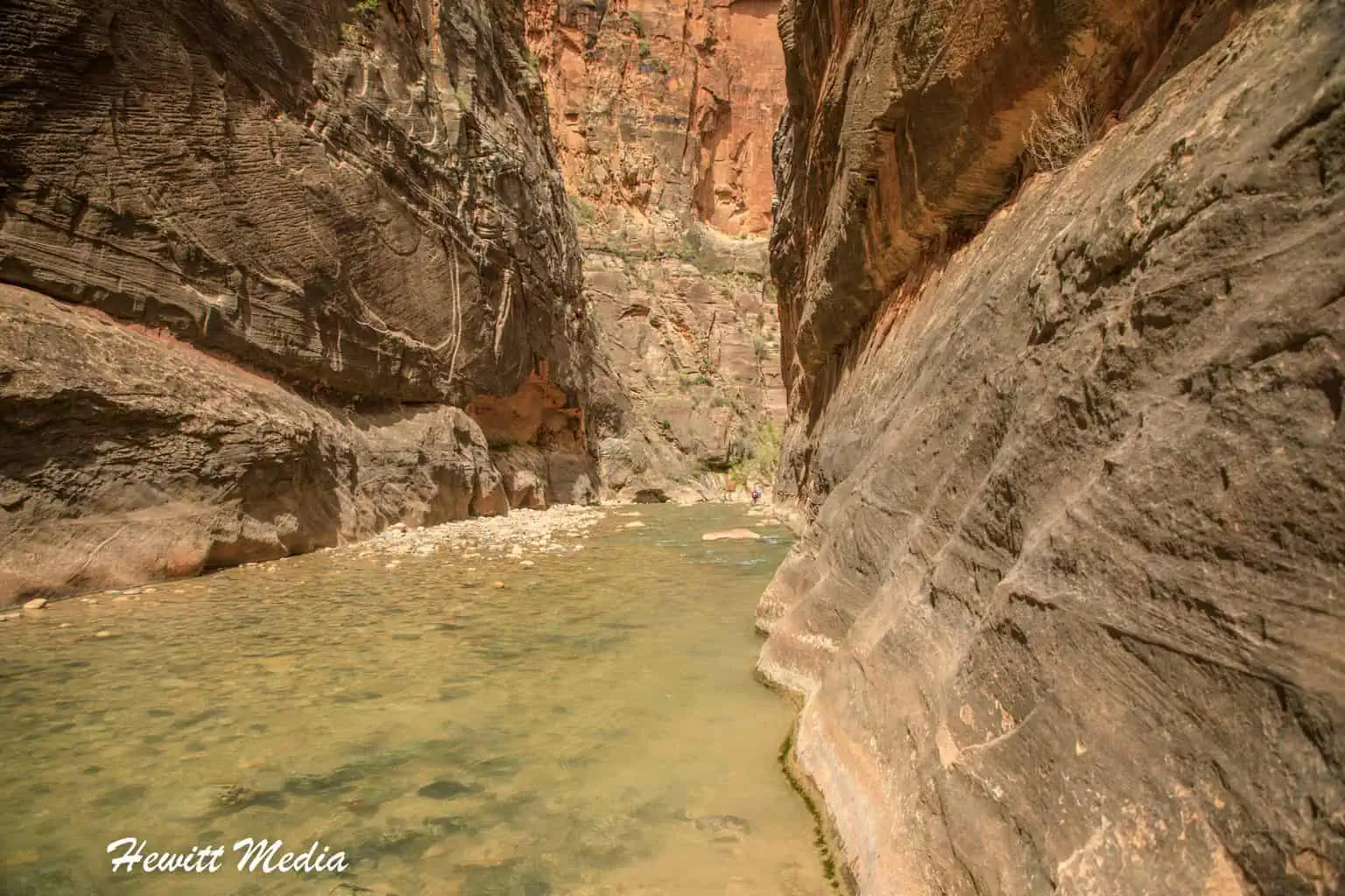
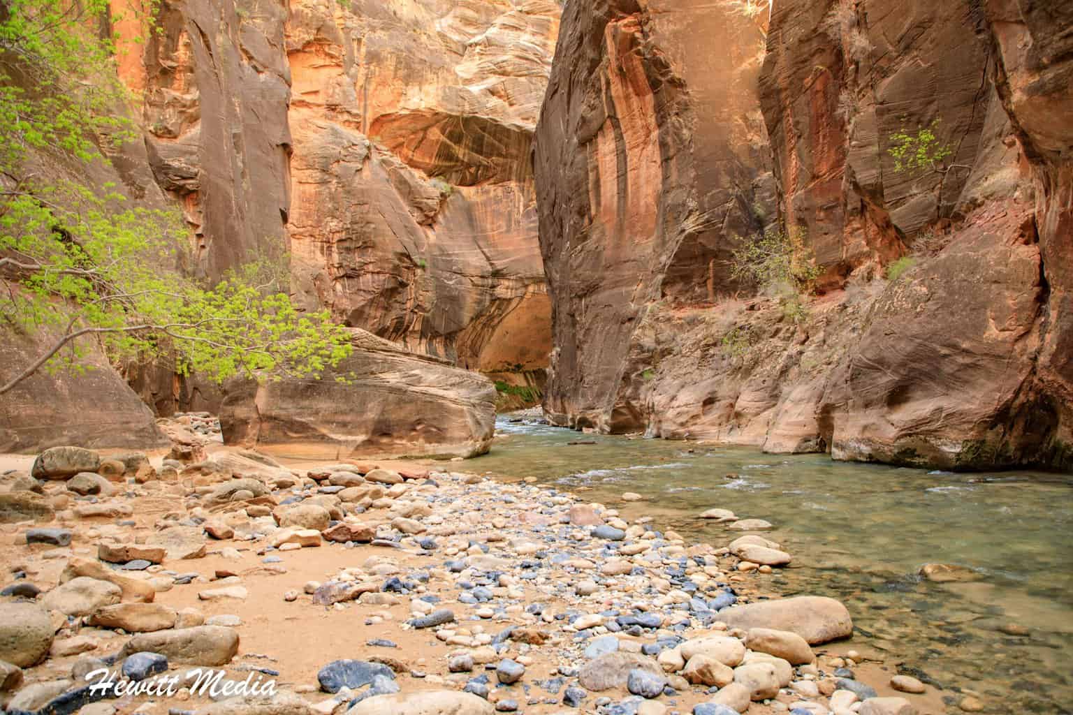
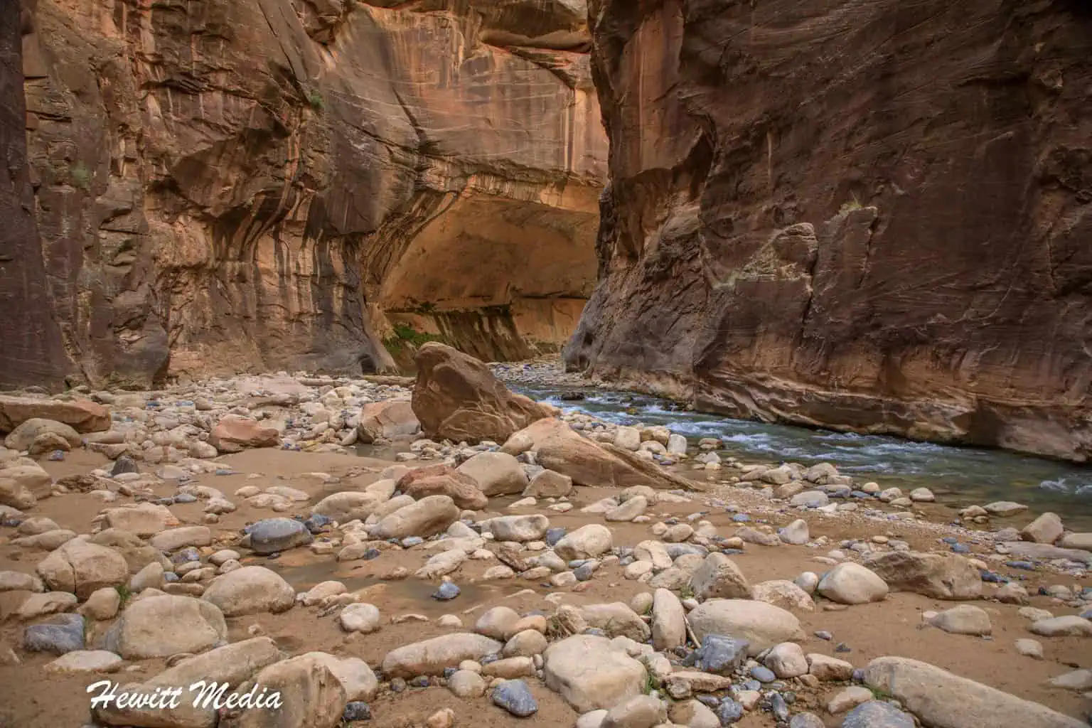
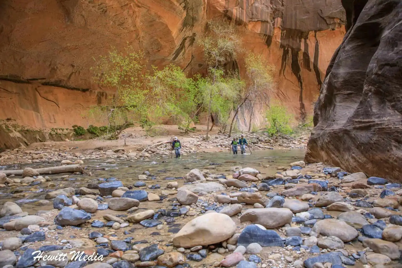
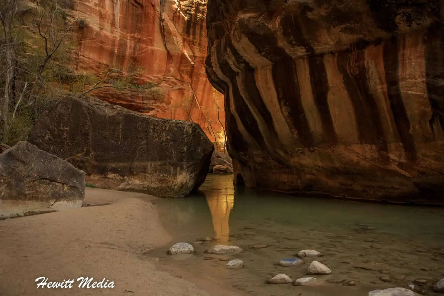
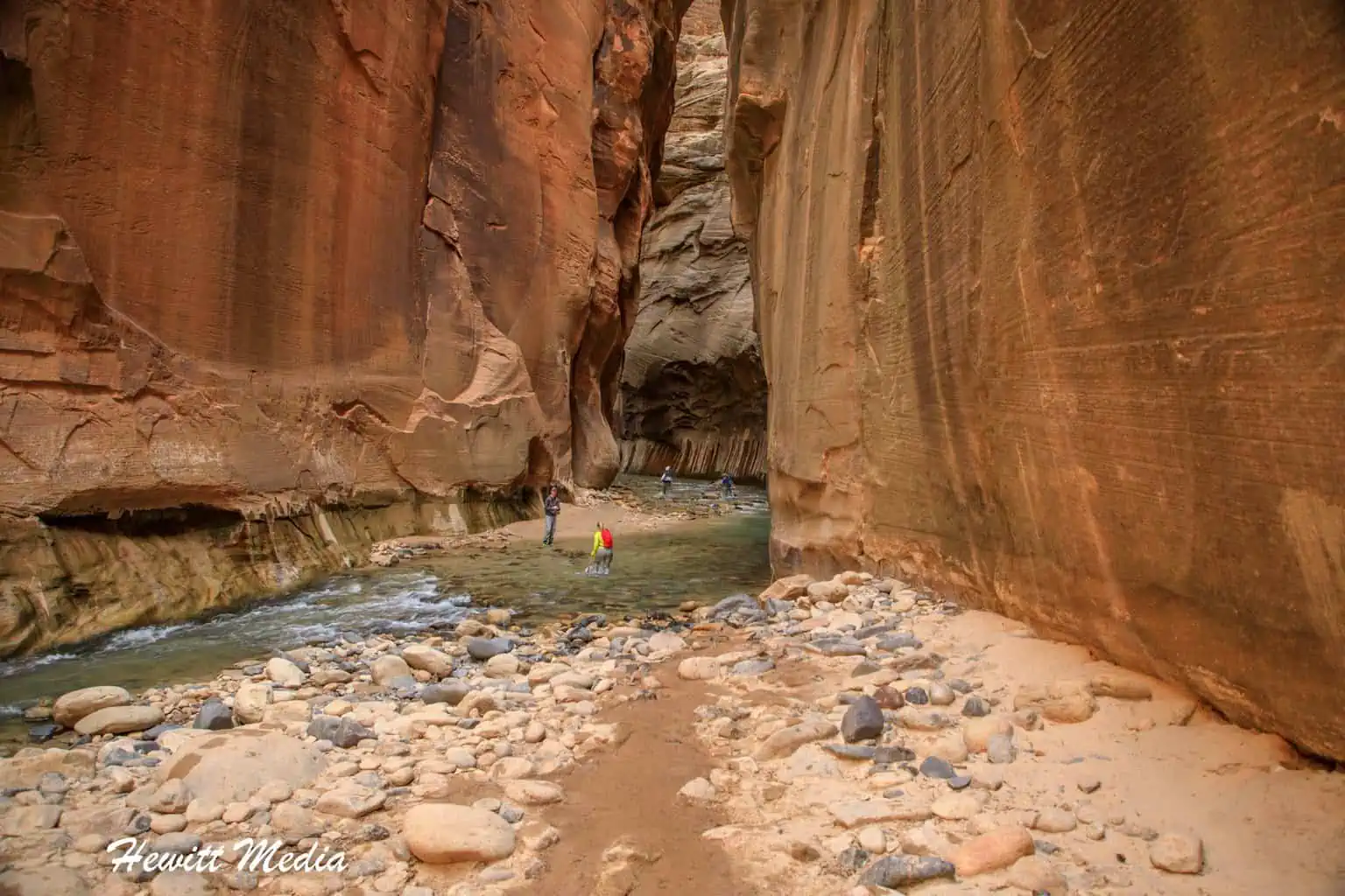
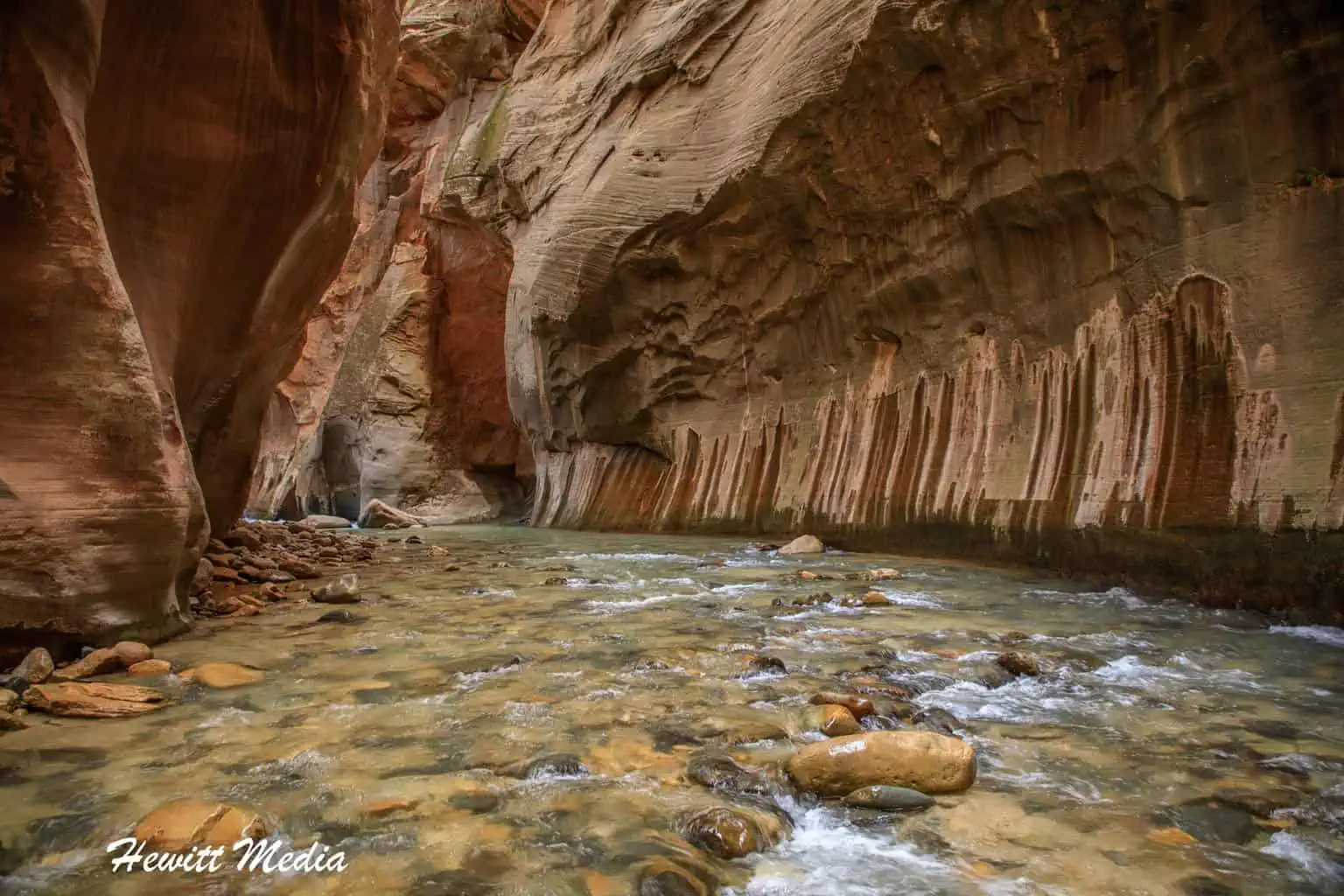
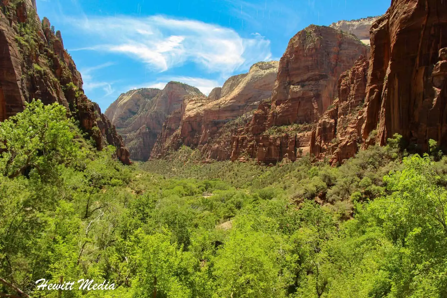
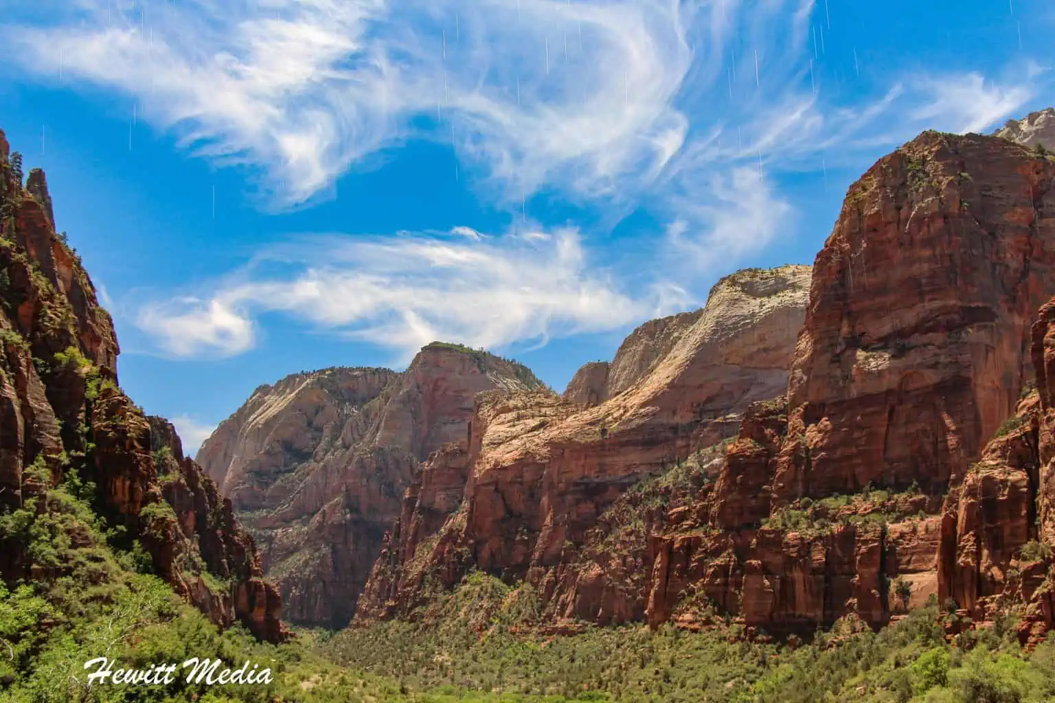
The Narrows Hike

The Narrows hike is one of the most famous in the national park system because of how unique it is. The Narrows hike features walking up (or down) the Virgin River in between the most spectacular slot canyons. As you can see from the photograph above, it really is an absolutely beautiful hike.
Bottom-up or Top-down
There are two different ways that you can approach the Narrows hike at Zion National Park. The bottom-up approach is the most popular way to do the hike and requires no permit from the Park Service to complete.
The Bottom-Up Hike
| The Narrows Bottom-Up Trail Stats | |
|---|---|
| Trail Type: | Out-and-Back |
| Distance: | 9.1 miles/14.6 kilometers |
| Elevation Gain: | 695 feet/212 meters |
| Time to Complete: | 4 to 8 hours |
| Difficulty Level: | Very Difficult |
With the bottom-up hike, you can hike up the Virgin River as far as Big Springs before you have to turn around. This is the mandatory turnaround point for all bottom-up hikers.
Most hikers will hike until they get to the “Wall Street” section of the trail, which features some of the most spectacular segments of the narrow slot canyon. On average, it will take roughly 3-4 hours to hike up to Wall Street, and then roughly 2-3 hours to get back to the trailhead.
| The Narrows Bottom-Up Trail Map |
|---|
The Top-Down Hike
| The Narrows Top-Down Trail Stats | |
|---|---|
| Trail Type: | Point-to-Point |
| Distance: | 16.8 miles/27 kilometers |
| Elevation Gain: | 2,076 feet/633 meters |
| Time to Complete: | 8 to 10 hours |
| Difficulty Level: | Strenuous |
The Top-down approach to the Narrows hike involves starting at Chamberlain’s Ranch and hiking the full 16 miles downriver to the trailhead. The hike typically takes between 10 and 14 hours to complete and is usually done over multiple days.
There are several spots to camp out along the river on your way down. This hike requires a reservation/permit (see link above) from the National Park Service to complete, so plan ahead if you would like to do this hike.
| The Narrows Top-Down Trail Map |
|---|
Be Safe (especially with children)
The Narrows hike might sound fun (and it really is), but it can also be extremely dangerous. Please be aware that on this hike, you are hiking in the Virgin River, and in most spots, there is no way out. You are hiking in between the slot canyon, so there is no respite should you get tired, or hurt, or if there is a flash flood.
Please be mindful if you decide to bring small children on this hike. The hike can get quite tiring as you are walking against the current on slippery rocks below the water’s surface. I have seen people with young children on their shoulders, which is quite dangerous. Please, use good judgment.
Check the River Conditions Before Hiking
If you plan on doing the Narrows hike, please make sure you monitor the current river conditions for the North Fork of the Virgin River. To help you interpret the data, 50 cfs is easy hiking and is an acceptable condition for children, whereas 100 cfs is an extremely difficult condition for even adults. If the current exceeds 120 cfs, the National Park Service will not issue any permits for top-down hikes. If the current exceeds 150 cfs, the Narrows trail will be closed in both directions.
Keep in mind that when the Narrows hike opens each year is largely dependent upon the river current. In some of the years with the highest winter snowfall, the Narrows hike hasn’t opened until mid-July. So make sure you monitor the river conditions and snowfall before planning your trip if the Narrows hike is high on your list.

Accessing the Trail
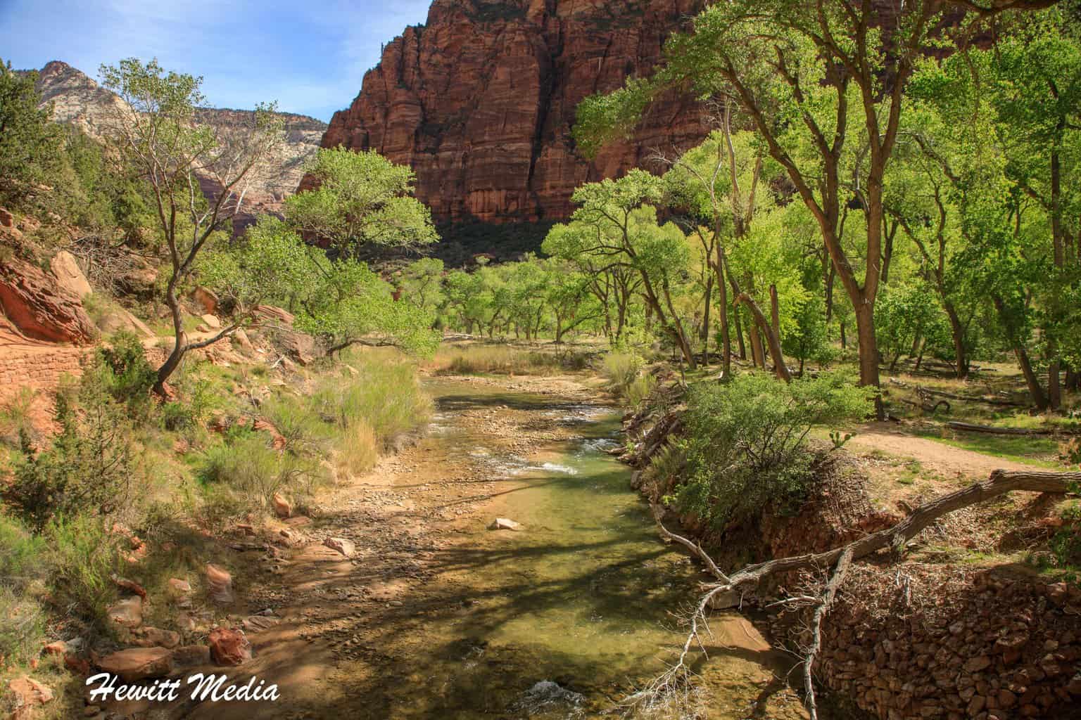
To access the Narrows hike, take the Zion Park Shuttle to the Temple of Sinawava stop, which is the last stop on the shuttle route. From the shuttle stop, take the Riverside Walk trail for 1 mile alongside the Virgin River until you reach the stairs that take you down into the river. This is the trailhead (or starting spot) for the bottom-up hike and the termination spot for top-down hikers.
Gear Rental

If you are planning on doing the Narrows hike, I would strongly recommend that you rent the proper gear to do the hike. Several different outfitters in Springdale can set you up with the proper gear. This gear will keep you warm, keep you safe, and make the hike much more enjoyable. The proper gear you will want to look into renting includes the following:
- Canyon Shoes (extra grip for the slippery rocks, and allows water to flow in and out of the shoes).
- Neoprene Socks
- Dry pants or dry suit
- Hiking Pole
My favorite place to rent from is the Zion Adventure Company in Springdale. They are really good people who really take care of you. They have some great packages of gear for the Narrows hike that you can rent.
Zion Adventure Company Location
Emerald Pools Hike

If you are up for taking a beautiful hike, but don’t want to take on something as difficult as Angel’s Landing or as time-consuming as the Narrows hike, then the Emerald Pools hiking trails are just what you are looking for. The Emerald Pools hiking trails are a series of trails that connect three pools of water inside Zion National Park.
| Emerald Pools Trail Stats | |
|---|---|
| Trail Type: | Loop |
| Distance: | 3 miles/4.8 kilometers |
| Elevation Gain: | 580 feet/177 meters |
| Time to Complete: | 1.5 to 2 hours |
| Difficulty Level: | Moderate |
The Lower Emerald Pool is a short three-quarter-mile hike and is classified as an “Easy” trail. This is one of the most frequented hikes in Zion National Park because of how easy it is to access and how pretty the trail is.
From the lower pool, the hike gets a bit more difficult as there is a 200-foot elevation change on the way to the Middle Emerald Pool. This pool is on top of the waterfall that you can see at the lower pool. The waterfall is actually the run-off from the middle pool.
For those who want a bit of a challenge, there are another 200 feet of elevation changes on the way to the Upper Emerald Pool. The views from the Upper Pool are pretty spectacular and are worth the effort to get up there.
| Emerald Pools Trail Map |
|---|
Accessing the Trail
To access the Emerald Pools trails, take the Zion shuttle service to the Zion Lodge stop. From the shuttle stop, cross over to the other side of the road to access the Lower Emerald Pool trail. The hike is a loop hike, so the starting and ending spots are at the same trailhead.
Court of the Patriarchs

The Court of the Patriarchs is pretty difficult to miss. These three prominent sandstone peaks are some of the largest within Zion Canyon. They are named after the biblical figures of Abraham, Isaac, and Jacob.
| Court of the Patriarchs Viewpoint Trail Stats | |
|---|---|
| Trail Type: | Out-and-Back |
| Distance: | 0.1 miles/0.2 kilometers |
| Elevation Gain: | 26 feet/8 meters |
| Time to Complete: | 0 to 0.5 hours |
| Difficulty Level: | Easy |
| Court of the Patriarchs Viewpoint Trail Map |
|---|
The Court of the Patriarchs trail is a trail that can be accessed from the Court of the Patriarchs shuttle stop, but it isn’t really much of a trail. In fact, you will likely walk further to get to the trailhead than you will on the actual trail. It is worth checking out, though, as the viewpoint at the end of the trail has some spectacular views.
Weeping Rock Trail

Another very easy hike that is worth exploring when you visit Zion National Park is the Weeping Rock trail. This very short hike does have some decent elevation change, but the trail isn’t very steep. It is classified as an easy hike for this reason. The trail takes you to a sandstone wall that is weeping water from it. It is a neat feature that is popular with kids.
| Weeping Rock Trail Stats | |
|---|---|
| Trail Type: | Out-and-Back |
| Distance: | 0.3 miles/0.5 kilometers |
| Elevation Gain: | 36 feet/11 meters |
| Time to Complete: | 0 to 0.5 hours |
| Difficulty Level: | Easy |
| Weeping Rock Trail Map |
|---|
Human History Museum

If you like museums, then you will love the Human History Museum in Zion National Park. This museum has some absolutely fabulous displays of American Indian history, prehistoric artifacts, and the evolution of Zion National Park. The museum is definitely worth checking out.
Where to Stay Near Zion

Depending on what level of adventure you are looking for, there are a variety of different accommodations near Zion National Park. For travelers looking to camp out in this extraordinary landscape, there are many wonderful campsites inside the park and in the surrounding area.
But don’t worry, there are plenty of options for travelers not looking to rough it in the outdoors as well. The surrounding area boasts a wide assortment of hotels and lodges for travelers of all budgets and tastes to choose from as well.
To make planning easier for you, I have provided you with several different recommendations to review in my Zion National Park guide below.
Campgrounds Near Zion National Park
When visiting the national parks and monuments of the United States, it is a really neat experience to camp out during your visit. Some of the best campgrounds in America can be found inside the country’s national parks and monuments and the surrounding areas.
This is especially true of Zion National Park, which is one of the most naturally beautiful parks in the United States. The breathtaking canyons, forests, and crystal clear streams create a wonderful camping setting. If you are interested in camping out during your visit, I have included a map of some nearby campgrounds for you to review in my Zion National Park guide below.
Hotels and Lodges Near Zion National Park
If camping is not your speed, you need not worry, as there are a variety of good hotels for you to choose from in the area as well. The nearby city of Springdale, Utah, is an incredible city that is built around supporting adventure activities in the Zion area.
Because of the popularity of the park, the city of Springdale has several wonderful hotels at different price points. Beyond Springdale, the nearby cities of Virgin, Hurricane, and La Verkin have some other hotels that you might want to consider as well. They are a bit further away, but still close enough to commute to the park.
If you are in the process of planning your trip to the park and are looking for recommendations on hotels in the area, I have included a map and list of recommended hotels for you to review in my Zion National Park guide below.

Tours and Excursions Near Zion

There are a lot of beautiful and amazing things to see in the Zion National Park area, but there are also a lot of really fun activities as well. If you are starting to plan your trip and are looking for some fun activities, I have included some suggestions for you to review in my Zion National Park guide below.
Zion National Park Area Tours and Activities
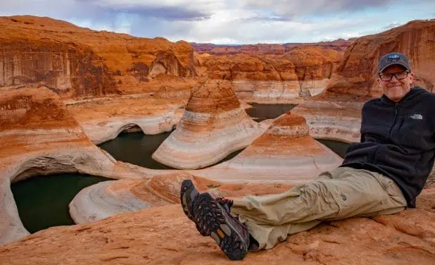
Zion National Park Photo Gallery
There are so many fantastic photo opportunities in Zion National Park. Below is a gallery of some of the photographs I have been able to take during my many visits to the park over the years.
If you’re interested in exploring more of my travel photography, I’d love for you to join me on Instagram! Creating this blog to share my free guides, itineraries, and travel photography tips takes a lot of effort, and a follow on Instagram would truly mean the world to me. Your support makes it all worthwhile!
FOLLOW ME!


Don’t Forget to Subscribe to My Adventures!

Let Me Help You Save On Your Next Adventure!
‘Start Exploring Today’ Merchandise Available Now!
 |
 |
 |
 |
 |
 |
 |


Is the name Zion related to Mount Zion which is referenced in the Bible? By the way your photos are stunning.
That is a really great question. I assume it is. And thank you so much!! 😀
Very informative guide to Zion!
Thank you so much!!