LAST UPDATED: 4/3/26 – Capitol Reef Park Guide
Southern Utah and its neighboring regions offer some of the best outdoor adventures in North America. With five national parks close together—and more parks and monuments in Southern Colorado and Northern Arizona—the area is a paradise for explorers. My Capitol Reef Park Guide highlights one of the Southwest’s hidden gems. While other Utah parks often steal the spotlight, Capitol Reef stands out for its solitude and stunning geology.
Set in the heart of red rock country, the park features natural bridges, domes, and cliffs formed along a 100‑mile geologic wrinkle called the Waterpocket Fold. This “reef” creates breathtaking formations and offers incredible hiking, backcountry camping, and ancient petroglyphs that bring the region’s history to life.

In this guide, I am going to give you all of the information you need to plan a successful trip. I cover the best times to visit and the best ways to get there so that you can maximize what you can see and do on your trip. In addition, I outline the top things to see and do while you are there, as well as the best places to stay and eat. With this information in hand, you can be confident that your trip to Capitol Reef National Park will be one that you remember for the rest of your life.
Capitol Reef National Park Guide Navigation Menu

How to Get to Capitol Reef National Park

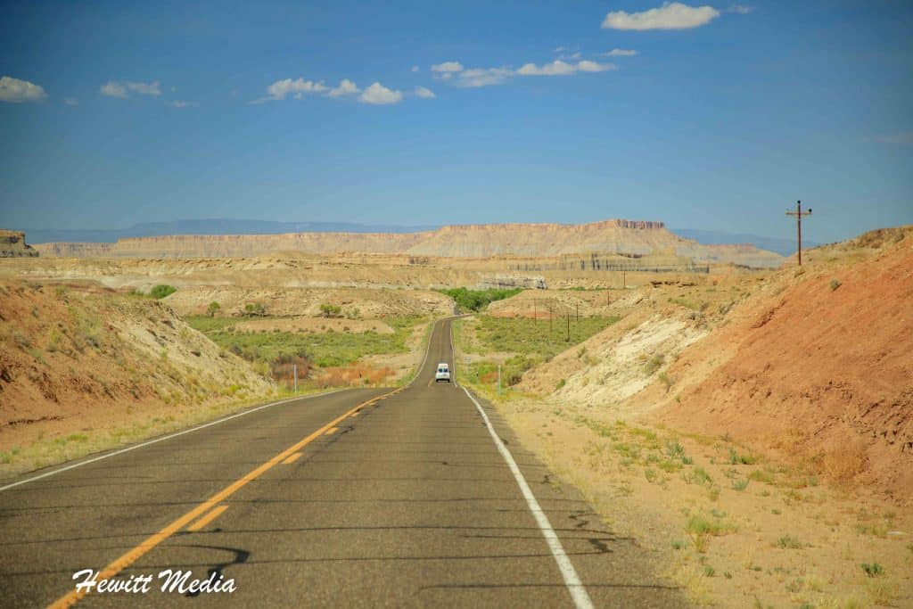
Capitol Reef National Park is located in the southern part of the state of Utah in the United States. It is one of five large national parks in the southern part of the state, which makes this area one of the most popular spots in the country for national park enthusiasts. If you are curious as to where this region is located, I have included a map in my Capitol Reef Park Guide above that pinpoints where Capitol Reef National Park is located inside the United States.
Drive Times to Capitol Reef National Park
| City\Park | Distance | Drive Time | Notes |
|---|---|---|---|
| Grand Staircase–Escalante National Monument | 60 miles | 1hr | Remote slot canyons and scenic drives. |
| Escalante Petrified Forest State Park | 65 miles | 1hr 25min | Fossilized wood and scenic reservoir. |
| Natural Bridges National Monument | 100 miles | 2hrs | Three massive natural stone bridges. |
| Kodachrome Basin State Park | 100 miles | 2hrs | Colorful sandstone spires and hiking trails. |
| Bryce Canyon National Park | 120 miles | 2hrs 30min | Famous for hoodoos and amphitheater views. |
| Arches National Park | 130 miles | 2hrs 30min | Iconic natural arches near Moab. |
| Dead Horse Point State Park | 130 miles | 2hrs 30min | Overlooks Canyonlands and Colorado River. |
| Canyonlands National Park | 140 miles | 2hrs 45min | Vast desert canyons and mesas. |
| Cedar City, UT | 160 miles | 3hrs | Closest airport (CDC). Regional airport with flights to Salt Lake City and Phoenix. Gateway to Zion and Bryce Canyon. |
| Glen Canyon National Recreation Area | 160 miles | 3hrs | Lake Powell and Colorado River vistas. |
| Goblin Valley State Park | 170 miles | 2hrs 25min | Unique hoodoo formations resembling goblins. |
| Zion National Park | 190 miles | 3hr 30min | Towering sandstone cliffs and slot canyons. |
| Salt Lake City, UT | 220 miles | 3hrs 45min | Major international airport (SLC). Good access to I‑15 and UT‑24. |
| Las Vegas, NV | 330 miles | 5hr | Large international airport (LAS). Scenic drive through Zion and Bryce Canyon. |
If you are looking to travel to see Capitol Reef National Park, the closest cities with major airports to fly into are Salt Lake City, Utah, and Las Vegas, Nevada. It is only a short drive from these cities to Capitol Reef, which you can use as your base of operations as you explore the park and the other treasures of the Southern Utah area.
In case you are curious as to how far Capitol Reef National Park is from other cities in the American West, I have included a chart of driving distances in my Capitol Reef Park Guide above and a regional map below for you to review.
Capitol Reef National Park Location Map
Many people who visit Southern Utah will fly into Las Vegas and complete a loop trip through Southern Utah and Northern Arizona to see all of the area’s national parks, monuments, and wonderful points of interest.
In addition to the five national parks in Southern Utah, the area is home to a myriad of other incredible sights. In Northern Arizona, you will find the iconic Grand Canyon, Horseshoe Bend, and the breathtaking Antelope Canyon. Elsewhere in Southern Utah, sights like Monument Valley, the Corona Arch, and the Grand Staircase-Escalante National Monument are there to enjoy.
Southwest United States National Park Itineraries
If you are interested in exploring an itinerary through this area, starting and ending in Las Vegas, I have included a few itineraries I created in my Capitol Reef Park Guide for you to review below.
| READ MORE: | |
 |
|
| Ultimate American Southwest Road Trip | |
| READ MORE: | |
 |
|
| 7-Day American Southwest Adventure Itinerary | |
If you would like to understand the layout of the park a little more, I have included a map of the park in my Capitol Reef Park Guide for you to review below. I have also included a link for you to download and save a PDF copy of the map to your phone or tablet.
This is the same map that you will be given at the entrance gates or park visitor centers when you visit, so you can get a head start on planning out your hikes and other activities before you visit.

Top Things to See and Do in Capitol Reef National Park

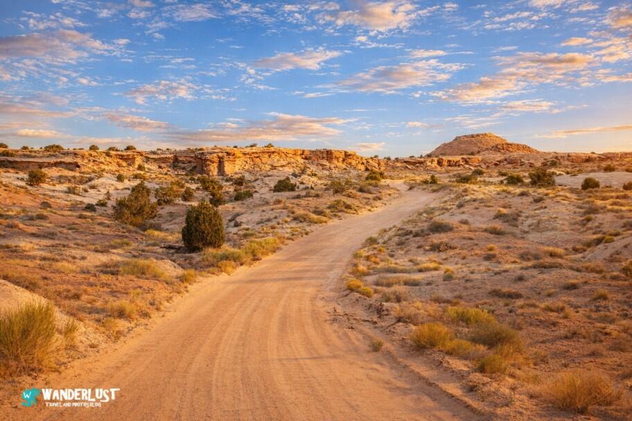
There is certainly no shortage of amazing things to see and do within Capitol Reef National Park and the surrounding area. The park is located in the heart of the Red Rock territory, which has made Southern Utah so popular amongst travelers and outdoor adventurers.
If you are starting to put together the itinerary for your visit and would like some tips on the top things to see and do in the area, I have included a list of my top things to see and do in my Capitol Reef Park Guide for you to review below.
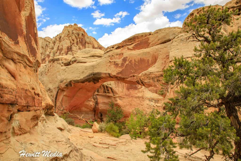
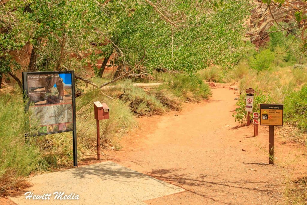
The Hickman Bridge Hike

The area around Capitol Reef National Park is famous for its amazing natural bridges and rock formations. One of the most popular of these formations is the Hickman Bridge. The short hike to see this beautiful natural bridge is neither long nor grueling, which makes it the perfect hike for visitors of all experience levels. If you are interested in doing this hike when you visit, I have included a trail map in my Capitol Reef Park Guide for you to review below.
Hickman Bridge Trail Stats
| Trail Type: | Out-and-Back |
| Distance: | 1.8 miles/2.9 kilometers |
| Elevation Gain: | 413 feet/126 meters |
| Time to Complete: | 1 to 1.5 hours |
| Difficulty Level: | Moderate |
Hickman Bridge Trail Map
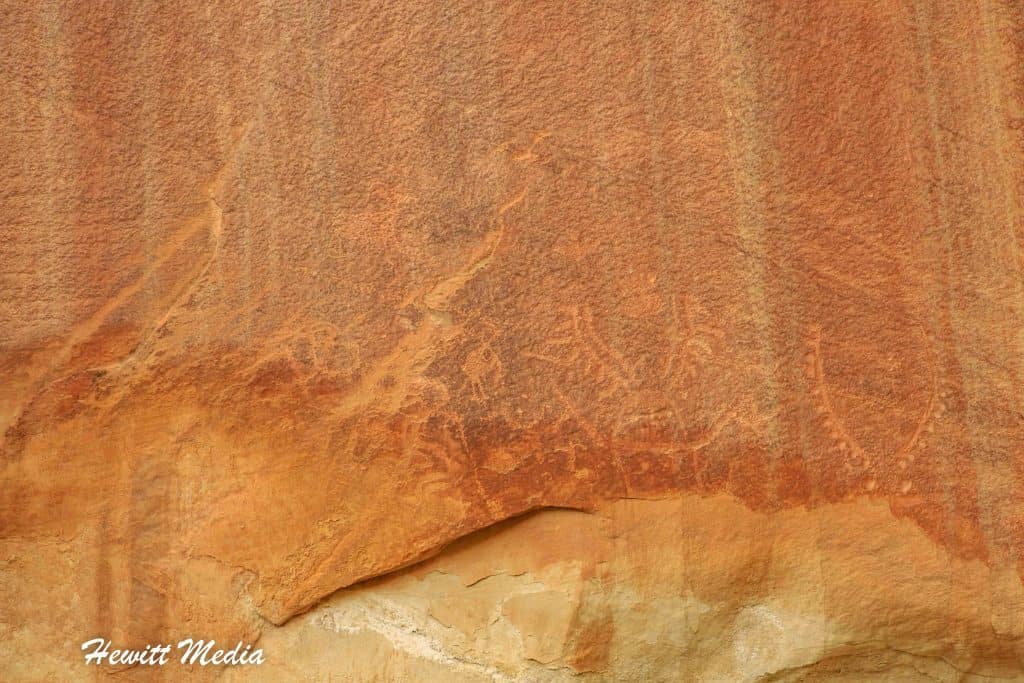
The Fremont Petroglyphs

Many people aren’t aware that the Southwestern United States has been inhabited by human beings for thousands of years. In fact, some of the remaining petroglyphs that you will find in the area have been dated back to 1,500 to 4,000 years ago. Inside Capitol Reef National Park, you will find a lot of petroglyphs that were created by the Fremont Culture that date back to 1000-1200 AD. You will be amazed at how these ancient drawings have survived on the rock faces as long as they have.
The Gifford Barn

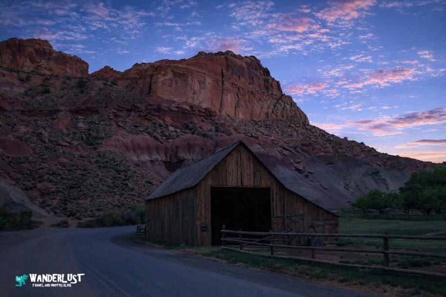
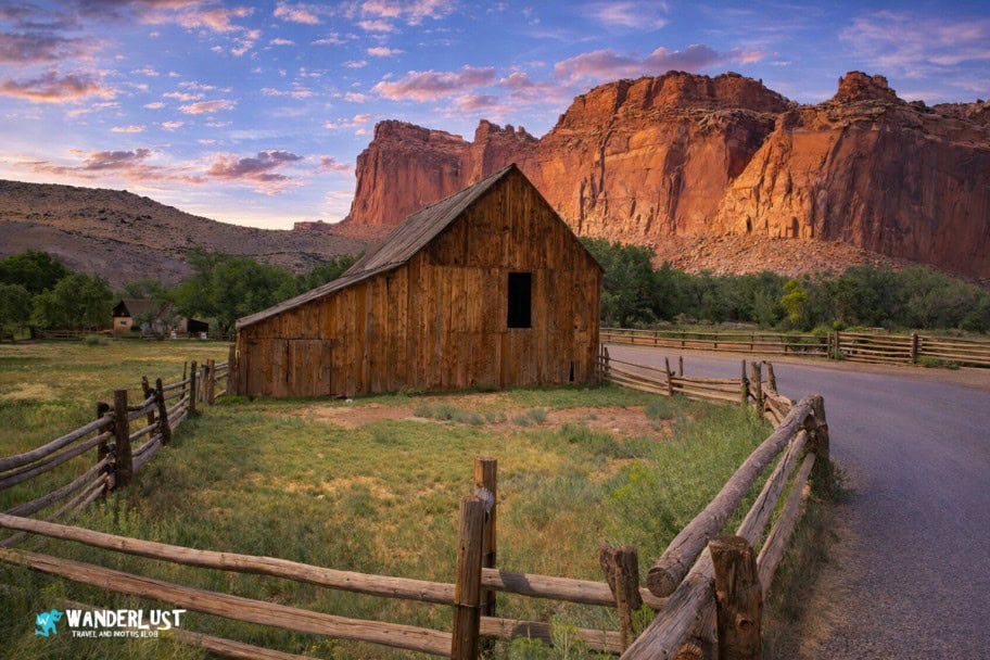
One of the best photo opportunities in Capitol Reef National Park is at one of the prettiest buildings that you will find in the national parklands of Southern Utah. The Gifford Barn, along with the Gifford House and the rest of the buildings on this 200-acre Mormon homestead in the Fruita Rural Historical District, were built in the early 1900s by a Mormon settler named Calvin Pendleton.
However, the homestead gets its name from the Gifford Family, who occupied the homestead from 1928 all the way up to 1969. In 1954, the Giffords built a small hotel for visitors coming to see Capitol Reef National Park, which was one of the first hotels in the area. If you would like to see some additional photos of the beautiful Gifford Barn, I have included some of my favorites in the Photo Gallery section of my Capitol Reef Park Guide.
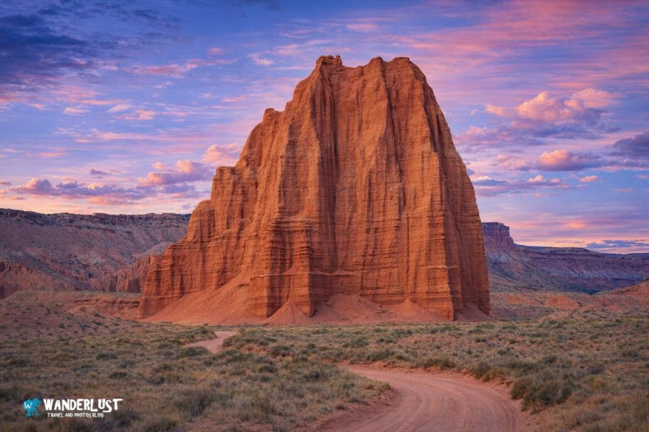
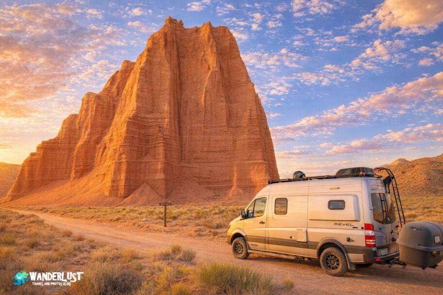
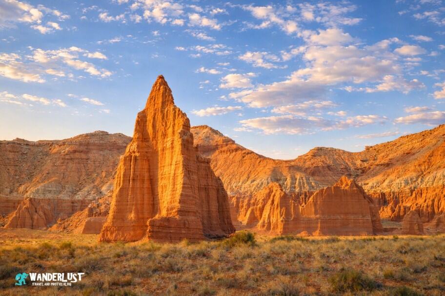
Cathedral Valley

One of my favorite places in Capitol Reef is the remote and stunning Cathedral Valley. This rugged area is home to some of the park’s most impressive formations, including the towering Temple of the Sun and Temple of the Moon—massive monoliths that are striking both from afar and up close.
To explore Cathedral Valley, I recommend a high‑clearance vehicle, ideally with 4WD. It’s not always required in dry conditions, but the roads become difficult and muddy after rain.
The Cathedral Valley loop covers about 58 miles, with the Temple of the Moon roughly 17 miles from Highway 24 along Cathedral Road. Continuing on Hartnet Road completes the loop, with the Lower South Desert Overlook being one of the most popular stops. A detailed map is included in my Capitol Reef Park Guide.
Cathedral Valley Loop Map
Capitol Gorge Trail

Another great hike that is easy for even novice hikers to complete inside Capitol Reef National Park is the Capitol Gorge Trail. Located in the Waterpocket Fold in the southern section of the park, the Capitol Gorge Trail takes hikers through narrow ravines, gulches, and washes and past a petroglyph panel, hundreds of historic signatures, a natural arch, and several water-filled potholes.
However, the ultimate prize is reaching the Capitol Gorge itself. If you are planning on completing the Capitol Gorge Hike, I have included a map in my Capitol Reef Park Guide for you to review below.
Capitol Gorge Trail Stats
| Trail Type: | Out-and-Back |
| Distance: | 4.8 miles/7.7 kilometers |
| Elevation Gain: | 324 feet/99 meters |
| Time to Complete: | 1.5 to 2 hours |
| Difficulty Level: | Moderate |
Capitol Gorge Trail Map
Best Times to Visit Capitol Reef National Park

Capitol Reef sits in Utah’s high desert, and its elevation may surprise you—the park tops out at 8,960 feet (2,731 meters), higher than Machu Picchu. This combination of desert climate and high altitude shapes the weather, so it’s important to factor conditions into your trip planning. If you want to understand what the park is like throughout the year—including temperatures, precipitation, and crowd levels—you’ll find detailed charts and visitor data in my Capitol Reef Park Guide below.
Average Temperature (°F)
If you plan to hike or explore the backcountry, pay close attention to Capitol Reef’s temperature swings. Summer highs (June–August) can reach well over 100°F—on my last visit, Cathedral Valley hit 116°F. Winter lows (December–February) often drop well below freezing. For the most comfortable conditions, aim for May or September if your schedule allows.
Average Precipitation (Inches)
Precipitation can also affect your trip, especially if you plan to hike or explore remote areas. Capitol Reef is driest from late autumn through early spring, with significantly more rainfall from late spring into early fall. For a clearer picture of what to expect, I’ve included a chart below showing average monthly precipitation.
Average Visitors (Visitors Per Day)
Crowd levels are another key factor when planning a trip to Capitol Reef. Visitor numbers affect trail congestion, viewpoint traffic, and the availability of campsites and backcountry permits. The park is busiest in late spring, with May as the peak month. Crowds dip during the hot midsummer period, then rise again in early fall, with September typically the second‑busiest month. If you want to avoid crowds and have an easier time securing campsites or permits, try to steer clear of these two months.
Other Things to See in the Area

The beauty of Southern Utah is legendary, and you won’t want to miss out on seeing any of it. In addition to the beauty of Capitol Reef National Park, there are also several other national parks, national monuments, and natural landmarks that I would recommend adding to your trip itinerary. If you would like to read more about these other wonderful places, I have included guides to some of my top recommendations for you to review below.
| READ MORE: | |
 |
|
| Arches National Park Visitor Guide | |
| READ MORE: | |
 |
|
| Canyonlands National Park Visitor Guide | |
| READ MORE: | |
 |
|
| Bryce Canyon National Park Visitor Guide | |
| READ MORE: | |
 |
|
| Guide to Long Canyon Slot in Grand Staircase – Escalante National Monument | |
| READ MORE: | |
 |
|
| Guide to Zebra Slot Canyon in Grand Staircase – Escalante National Monument | |
Where to Stay Near Capitol Reef National Park

Campgrounds
When visiting the national parks and monuments of the United States, it is a really neat experience to camp out during your visit. Some of the best campgrounds in America can be found inside the country’s national parks and monuments and the surrounding areas. If you are interested in camping out during your visit, I have included a map of some recommended campgrounds for you to review below.
If camping is not your speed, you need not work as there are a variety of good hotels for you to choose from in the area as well. If you are in the process of planning your trip to Capitol Reef National Park and are looking for recommendations on hotels in the area, I have included a map and list of recommended hotels and different price points for you to review below.


Capitol Reef National Park Resources

When planning any trip, you can never have too many resources at your disposal. In addition to the information I have provided in this guide, I have linked to several official resources from the US National Park Service below for you to use to plan your trip as well.
- Operating Hours and Seasons
- Permits and Reservations
- Park Map
- Local Services
- Campgrounds
- South (Waterpocket) District
- North (Cathedral Valley) District
- Outdoor Activities
- Activities For Kids
- Plants and Animals in the Park
Activities in the National Park Area

In addition to the beautiful landmarks, rock formations, and native history that you can see within Capitol Reef National Park, there are also several great activities for you to enjoy in the area. If you are looking for some fun things to do on your trip to fill out your itinerary, I have included links to some activities for you to consider in my Capitol Reef Park Guide below.
Recommended Sightseeing and Airplane Tours in Moab, Utah
Recommended Rafting and Paddle Board Tours in Moab, Utah
Recommended ATV and Off-Road Tours in Moab, Utah
Recommended Climbing and Canyoneering Tours in Moab, Utah
Recommended Bike Rental in Moab, Utah
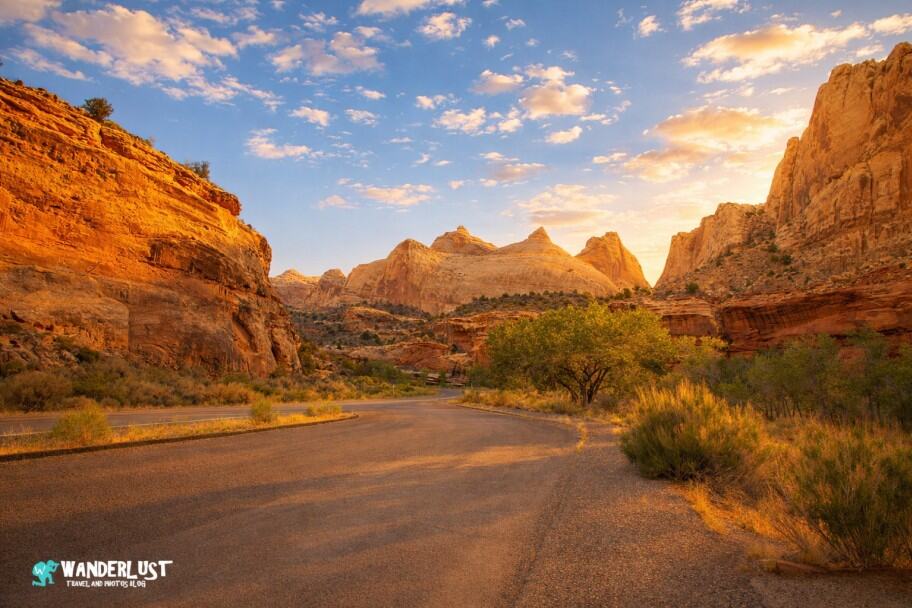
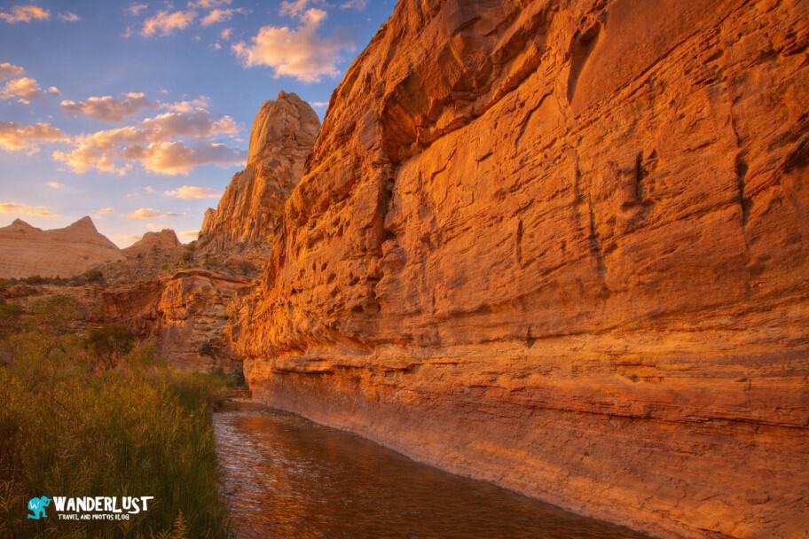
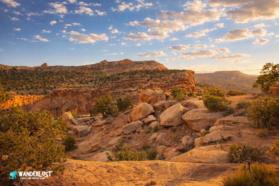
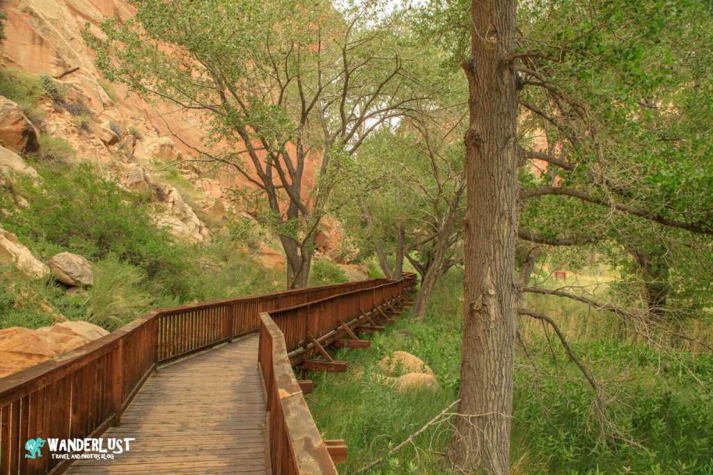
Capitol Reef National Park Photo Gallery
There are a lot of very pretty spots inside Capitol Reef National Park to take photographs, so make sure you bring your camera with you when you visit. If you would like to see some of the stunning shots I was able to take during my many visits, I have included some of my favorites in a gallery in my Capitol Reef Park Guide below for you to review.
If you’re interested in exploring more of my travel photography, I’d love for you to join me on Instagram! Creating this blog to share my free guides, itineraries, and travel photography tips takes a lot of effort, and a follow on Instagram would truly mean the world to me. Your support makes it all worthwhile!
FOLLOW ME!


Don’t Forget to Subscribe to My Adventures!

Let Me Help You Save On Your Next Adventure!
‘Start Exploring Today’ Merchandise Available Now!
 |
 |
 |
 |
 |
 |
 |


Very complete, as usual. Many thanks.
Thank you so much for the kind words! 😀
I really appreciate how much detail you put into your posts, I know how much time that takes. Thank you! I spent 1 day at Capitol Reef about 10 years ago and definitely a return trip is warranted; bookmarking this for when that day comes!
Thank you so much for the kind words Diana! It means a lot!! 😀