Last Updated: 4/11/26 – Rocky Mountain National Park Guide
The Rocky Mountains are home to some of America’s most breathtaking landscapes, and nowhere are they better showcased than in Rocky Mountain National Park. Creating this Rocky Mountain National Park Guide was a joy, because this park truly deserves the spotlight.
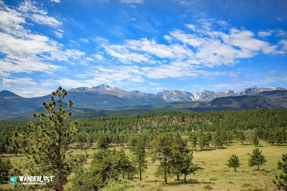
With elevations ranging from 7,600 to 14,259 feet (2,316–4,346 meters), the park offers an incredible mix of alpine scenery and wildlife. More than 280 bird species, abundant elk, and the iconic bighorn sheep all thrive here. It’s also a magnet for climbers and adventurers, especially those aiming for Long’s Peak—one of Colorado’s most challenging 14ers.

If back‑country hiking isn’t your style, the park still delivers unforgettable views thanks to America’s highest continuous paved road, which lets you experience high elevations without the effort. It’s no surprise that over 3 million people visit each year, making it one of the most popular national parks in the West.
In this Rocky Mountain National Park guide, you’ll find everything you need to plan a seamless trip—from the best times to visit and how to get there to the top sights and where to stay. With these insights, your planning will be stress‑free, and your visit will be one you’ll remember for years to come.
Rocky Mountain National Park Guide Navigation Menu

How to Get to Rocky Mountain National Park

Rocky Mountain National Park is located in Northern Colorado, very close to the city of Denver. In fact, if you are planning on visiting Rocky Mountain National Park from outside of the United States, the easiest way to visit is undoubtedly to fly into Denver International Airport (DEN) and then to Estes Park, Colorado, which is located just outside of the park. The roughly 66-mile (106-kilometer) drive will take you roughly 1.5 hours.
If you are planning on visiting other areas in the Western United States and are planning on driving to Rocky Mountain National Park during your trip, I have included a table in my Rocky Mountain National Park Guide below that outlines the driving distance and time to Rocky Mountain National Park from other large cities in this region of the United States.
Drive Times to Rocky Mountain National Park
| City\Park | Distance | Drive Time | Notes |
|---|---|---|---|
| Loveland, CO (Northern Colorado Regional Airport – FNL) | 42 miles | 1hr | Closest airport to RMNP; small regional hub with limited flights; gateway to Estes Park. |
| Eldorado Canyon State Park | 55 miles | 1hrs 20min | Famous for rock climbing; scenic canyon near Boulder. |
| Arapaho National Recreation Area | 70 miles | 1hrs 30min | Lakes and forests near Grand Lake; boating and fishing. |
| Denver, CO (Denver International Airport – DEN) | 72 miles | 1hr 45min | Major international airport; extensive domestic and global routes; rental cars and shuttles to Estes Park. |
| Staunton State Park | 90 miles | 2hrs | Granite cliffs, waterfalls, and trails; popular for rock climbing and mountain biking. |
| Cheyenne, WY (CYS) | 97 miles | 2hrs | Regional airport; flights mainly to Denver; convenient for Wyoming travelers. |
| Colorado Springs, CO (COS) | 145 miles | 2hrs 45min | Full-service airport; connects to major U.S. cities; scenic drive via I‑25 and US‑36. |
| Florissant Fossil Beds National Monument | 150 miles | 3hrs | Preserves ancient fossilized plants and insects in volcanic ash beds. |
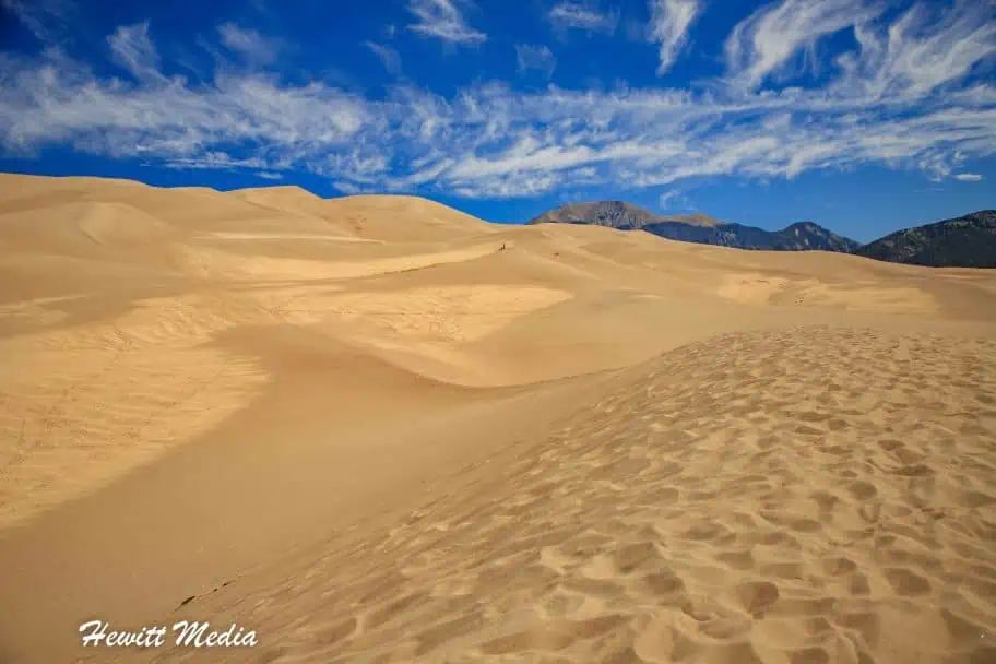
| Great Sand Dunes National Park (CO) | 250 miles | 5hrs | Tallest dunes in North America; unique combination of desert and alpine ecosystems. |
| Curecanti National Recreation Area | 260 miles | 4hrs 30min | Reservoirs and boating areas along the Gunnison River; fishing and scenic drives. |
| Black Canyon of the Gunnison National Park (CO) | 270 miles | 5hrs | Dramatic steep canyon carved by the Gunnison River; excellent viewpoints and hiking. |
| Colorado National Monument | 285 miles | 5hrs | Red sandstone canyons and monoliths near Grand Junction; great for hiking and photography. |
While road-tripping is a hallmark of American travel, especially when visiting the country’s national parks is part of the itinerary, I am well aware that long drives are not for everyone. If you would prefer to fly out to the Western United States to begin your adventure, several other large cities in the region have large airports.
Airports in the Rocky Mountain Region
If you are planning a trip to the Rocky Mountain region or the Western United States in general and would like to review some airport options, I have included a map of some of the major cities in the region besides Denver that you can fly into to start your adventure.
At 265,461 acres (414.78 sq mi; 1,074.28 km 2) in size, Rocky Mountain National Park is one of the largest parks in the Continental United States. This can make seeing everything you want to see an exercise in logistics, even if you have a well-constructed plan.
To help familiarize you with the park so that you can better prepare your itinerary before arriving at the park, I have included a Rocky Mountain National Park map for you to review below. You will be given a park map at the entrance, but it may help your planning efforts to download the park map PDF that I included below to start your planning ahead of your arrival.

Top Things to See and Do in Rocky Mountain National Park

One thing that the Rocky Mountain National Park is definitely not in short supply of is amazing things to see and do. In fact, there are so many beautiful landscapes and fun adventures that you can have in the park and surrounding area that I recommend spending at least a few days exploring the park if possible.
If you don’t have a few days, I would absolutely recommend getting to the park early and spending as much of the time you have in the park. If you would like some recommendations for the top things to see in the park, I have included a list of my favorite things to see and do in the park in my Rocky Mountain National Park Guide below.

| The Trail Ridge Road | |
| Longs Peak Trailhead | |
| The Alpine Visitor Center (Wildlife Viewing) | |
| Sprague Lake | |
| Bear Lake Nature Trail | |
| Emerald Lake | |
| Alberta Falls | |
| The Forest Canyon Overlook | |
| Chasm Lake | |
| Dream Lake |
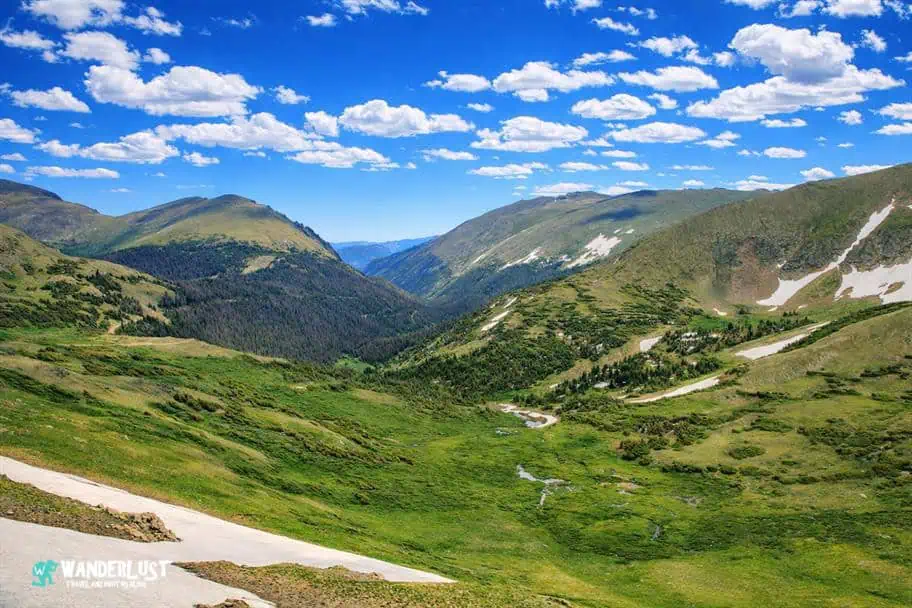
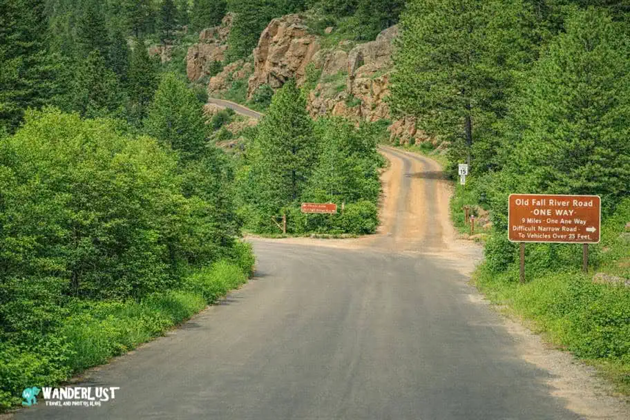
Trail Ridge Road

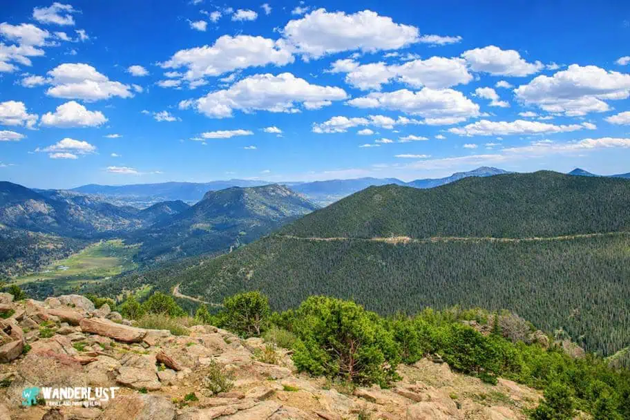
Reaching roughly 12,183 feet (3,713 meters) at its highest point, the Trail Ridge Road is the highest continuous paved road in the United States. However, the Trail Ridge Road is much more than a road. This roughly 48-mile-long road is one of the best ways to get a panoramic view of the beautiful Rocky Mountain National Park.
With breathtaking viewpoints, of which there are roughly eleven, visitors can get up above the tree line and enjoy the spectacular mountain vistas without having to summit up one of the park’s many peaks. If you are interested in seeing where this amazing road takes you within the park, I have included a map for you to review in my Rocky Mountain National Park Guide below.
NOTE: The Trail Ridge Road is closed during the winter months, so please keep this in mind when you are planning your trip to Rocky Mountain National Park. I would suggest checking the Park Service website for road conditions before heading to the park to make sure the road will be accessible during your visit.
Trail Ridge Road Map
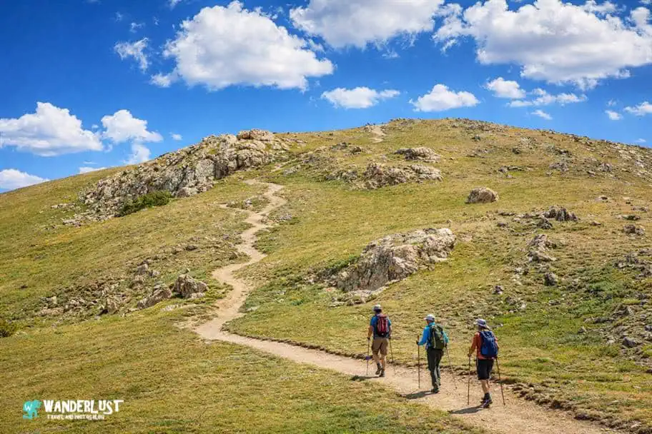
Longs Peak

One of the biggest draws to Rocky Mountain National Park for outdoor adventurers is the challenge of summiting Longs Peak, which at 14,259 feet ( 4,346 meters) is the 13th highest peak in Colorado and the highest peak inside the park. While Longs Peak may not be the tallest mountain in Colorado, it is one of the most technically challenging of the state’s 53 fourteen-thousand-foot-high peaks, also known as 14ers.
If you are considering summiting the Longs Peak Keyhole Route, you should make sure that you are prepared with the proper gear and plan on camping out near the trailhead so that you can get an early start in the morning. This will ensure that you can summit and get back down safely while there is still light.
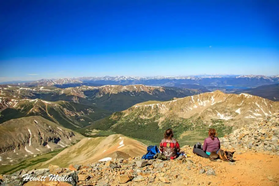
Grays and Torreys Peaks, which are located relatively close to the park, are taller peaks, but much easier to summit. If you are interested in doing some challenging hiking but are worried that Longs Peak is too technically challenging for you, I would suggest that you consider summiting those peaks instead. They are located close together and can both be summited on the same hike, which is an added bonus.
Download the Longs Peak Keyhole Route Brochure
Long’s Peak Trail Stats
| Trail Type: | Out-and-Back |
| Distance: | 13.6 miles/21.9 kilometers |
| Elevation Gain: | 4,934 feet/1,504 meters |
| Time to Complete: | 10 to 15 hours |
| Difficulty Level: | Expert |
Long’s Peak Trail Map
Wildlife Viewing

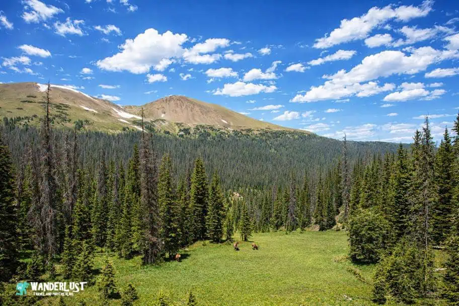
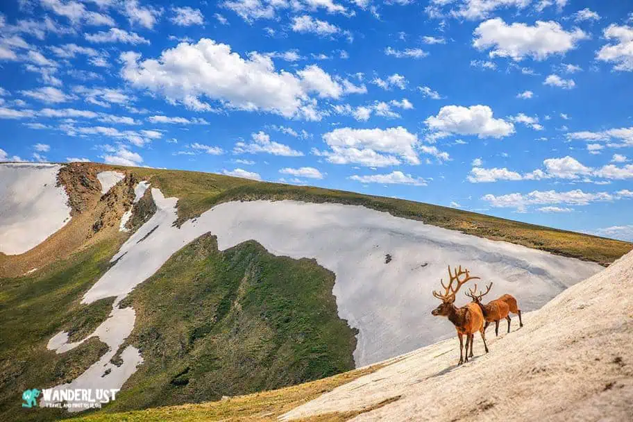
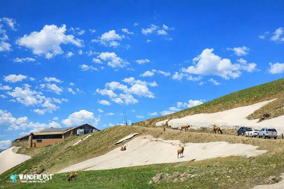
In addition to the breathtaking vistas, mountain lakes, and beautiful waterfalls that the park is known for, Rocky Mountain National Park is also home to a wide array of wildlife. This abundance of wildlife is another reason that the park has become so popular.
Not only is there a wide array of bird species that can be spotted in the park, but several of North America’s most popular mammals can also be seen by visitors on occasion.
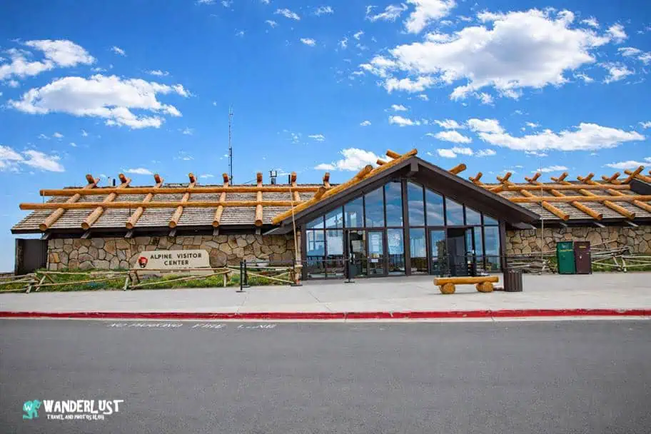
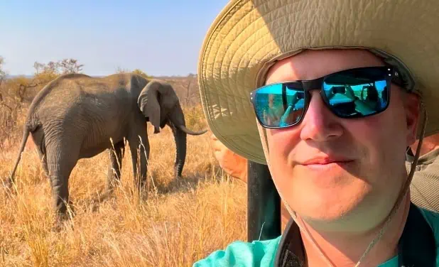
This includes but is not limited to Rocky Mountain elk, bighorn sheep, black bears, moose, marmots, coyotes, mule deer, mountain lions, and the adorable little pika. If you visit the Alpine Visitor Center, which is located near the highest point of Trail Ridge Road, you have a very good chance of spotting elk grazing in the alpine meadows.
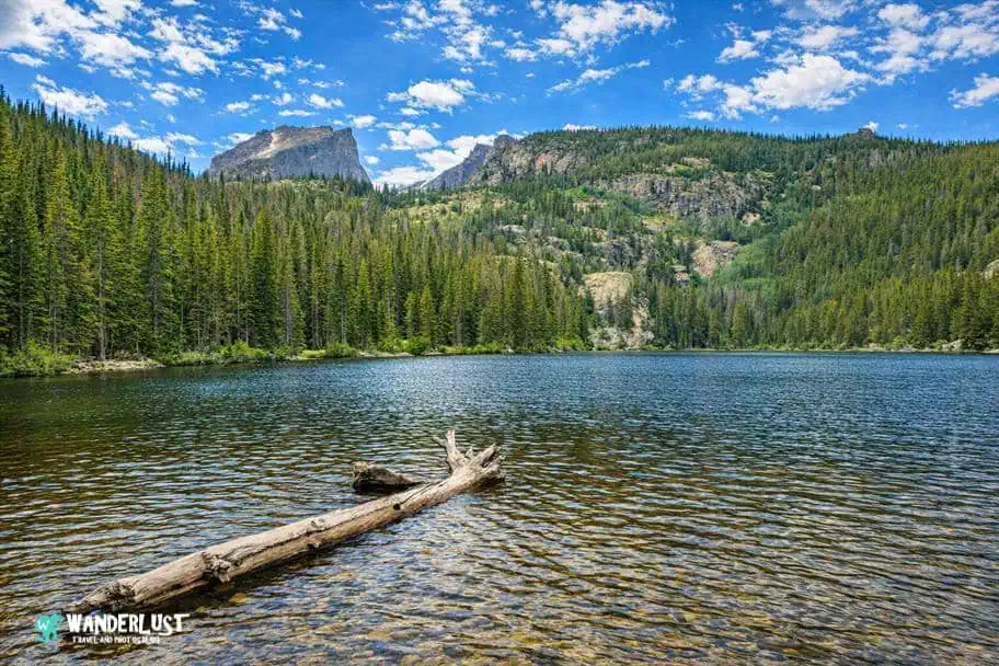
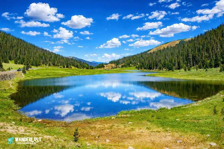
Sprague Lake

If you are comfortable getting out of your car and doing a little walking, many breathtakingly beautiful alpine lakes can be explored within Rocky Mountain National Park. While they are all beautiful, Sprague Lake is one of my favorites.
Not only is the lake beautiful, but it is also relatively easy to access. If you are looking to escape the crowds and find a little tranquility, the short hike to the lake is a great way to find some quiet and enjoy the beauty of the park.
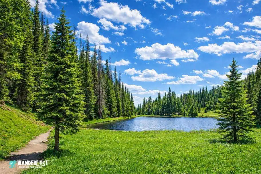
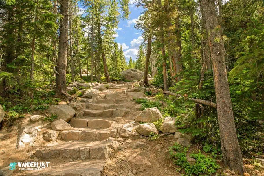
Bear Lake Nature Trail

If you would like to get out and do some hiking in Rocky Mountain National Park, but don’t have a lot of hiking experience, then one of the best trails that I can recommend is the Bear Lake Nature Trail. This loop trail takes you around the stunning Bear Lake and is an easy hike to complete for even the most novice of hikers.
You can take your time as you hike and enjoy the beauty of the lake and the surrounding woods. If you’re lucky, you might even spot some of the native wildlife inside the park. If you would like more details on the Bear Lake Nature Trail, I have included a map for you to review in my Rocky Mountain National Park Guide below.
Bear Lake Nature Trail Stats
| Trail Type: | Loop |
| Distance: | 0.7 miles/1.1 kilometers |
| Elevation Gain: | 49 feet/15 meters |
| Time to Complete: | 0.5 to 1 hours |
| Difficulty Level: | Easy |
Bear Lake Nature Trail Map
Emerald Lake Trail

The hike to Emerald Lake is one of the most iconic short routes in Rocky Mountain National Park, leading you past Nymph Lake and Dream Lake before arriving at one of the park’s most dramatic alpine cirques. For this Rocky Mountain National Park guide, it’s a perfect example of how quickly visitors can reach high‑elevation scenery—just over three miles round‑trip, with steady but manageable elevation gain and nonstop views of peaks, forests, and clear mountain water.
At the trail’s end, Emerald Lake sits beneath the sheer walls of Hallett Peak and Flattop Mountain, its color shifting from deep green to bright turquoise depending on the light and season. The setting feels surprisingly wild despite the trail’s popularity, making it a standout recommendation for this Rocky Mountain National Park guide. If you’d like, I can also write a version tailored for a specific audience—families, first‑time visitors, or photographers.
Emerald Lake Trail Stats
| Trail Type: | Out-and-Back |
| Distance: | 3.3 miles/5.3 kilometers |
| Elevation Gain: | 715 feet/218 meters |
| Time to Complete: | 1.5 to 2 hours |
| Difficulty Level: | Moderate |
Emerald Lake Trail Map
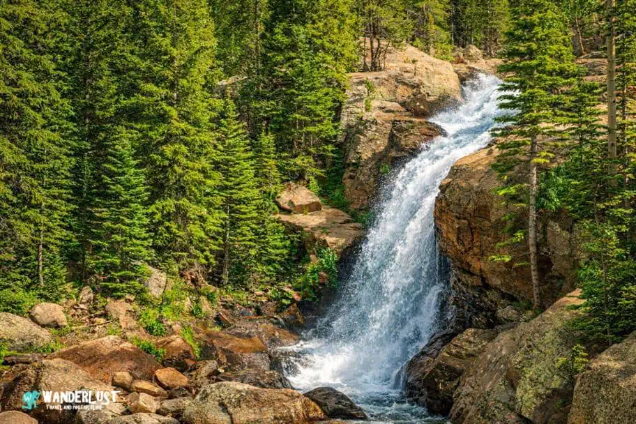
Alberta Falls

My favorite waterfall in Rocky Mountain National Park is, without a doubt, the breathtakingly beautiful Alberta Falls. Located just a short distance from Bear Lake, the trail to Alberta Falls is a relatively easy out-and-back that is fit for hikers of all experience levels.
The falls are located just off the trail, and there are multiple different vantage points where you can view this beautiful waterfall. If you would like more details on the trail to Alberta Falls, I have included a map for you to review in my Rocky Mountain National Park Guide below.
Alberta Falls Trail Stats
| Trail Type: | Out-and-Back |
| Distance: | 1.7 miles/2.7 kilometers |
| Elevation Gain: | 229 feet/70 meters |
| Time to Complete: | 0.5 to 1 hours |
| Difficulty Level: | Easy |
Alberta Falls Trail Map
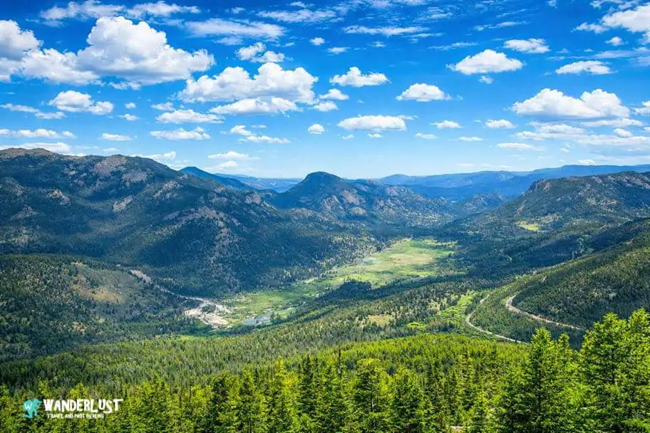
Forest Canyon Overlook

There are a lot of beautiful viewpoints located off the Park Ridge Road inside Rocky Mountain National Park. While the viewpoints at the higher altitudes near the Alpine Visitor Center get most of the attention, an often under-appreciated viewpoint that I love is the Forest Canyon Overlook.
The viewpoint sits right along the Continental Divide and provides easy access to the roughly 30-mile-long Continental Divide Trail, which runs down the middle of the park and splits it into its Eastern and Western sections. If you have the time, hiking some of the trails is a very fun experience.
The Continental Divide is one of the park’s most popular attractions because of its significance. It is the invisible line that runs down the Rocky Mountain Range, determining whether water flows off the mountains in an eastward or westward direction.
Chasm Lake

The hike to Chasm Lake delivers some of the most dramatic alpine scenery in the park, leading you from quiet forest into a wide, windswept basin framed by granite cliffs. For this Rocky Mountain National Park guide, it captures the feeling of stepping into true high country—waterfalls, tundra, and the rising face of Longs Peak all unfolding as you climb.
Chasm Lake rests directly beneath the Diamond, a sheer wall that creates one of Colorado’s most striking natural amphitheaters. The lake’s clear water and the towering rock above give the basin an almost cathedral‑like atmosphere, especially in the early morning light. Its rugged beauty makes it an essential highlight for this Rocky Mountain National Park guide.
Chasm Lake Trail Stats
| Trail Type: | Out-and-Back |
| Distance: | 8.4 miles/13.5 kilometers |
| Elevation Gain: | 2,545 feet/776 meters |
| Time to Complete: | 5 to 7 hours |
| Difficulty Level: | Difficult |
Chasm Lake Trail Map
Dream Lake

Dream Lake is one of the most photogenic spots in the park, with a trail that quickly opens to sweeping views of Hallett Peak and the surrounding ridgelines. For this Rocky Mountain National Park guide, it represents an accessible alpine experience—clear water, dramatic cliffs, and a sense of being deep in the mountains without a long or difficult approach.
At the lake, the water often reflects the peaks with near‑perfect clarity in the morning, creating one of the park’s most iconic scenes. The narrow basin funnels light and wind in ways that make the landscape feel alive, from rippling water to shifting shadows on the rock walls. Its combination of beauty and ease makes Dream Lake an essential highlight for this Rocky Mountain National Park guide.
Dream Lake Trail Stats
| Trail Type: | Out-and-Back |
| Distance: | 2 miles/3.2 kilometers |
| Elevation Gain: | 459 feet/140 meters |
| Time to Complete: | 1 to 1.5 hours |
| Difficulty Level: | Moderate |
Dream Lake Trail Map
When to Visit Rocky Mountain National Park

Average Temperature (°F)
Rocky Mountain National Park’s high elevation and northern location make winters cold and snowy, creating ideal conditions for snowshoeing and other winter activities but less comfortable for long days of hiking. Trails, roads, and overlooks can be icy or snow‑covered, and temperatures often stay low throughout the day.
For milder weather and easier trail access, it’s best to avoid November through March. Summer brings warm, pleasant conditions but also the largest crowds. If you want comfortable temperatures without peak‑season congestion, April, May, September, and October offer the best balance.
Average Precipitation (Inches)
August is surprisingly the wettest month in Rocky Mountain National Park, so visitors should be prepared for frequent afternoon storms. In contrast, the driest stretch typically runs from October through March, offering clearer skies but colder conditions. Winter can be beautiful, but it’s not ideal for high‑altitude hiking or attempting Longs Peak. For more reliable weather and drier trails, mid‑autumn and early summer are the best times to plan alpine hikes or climbs.
Average Visitors (Visitors Per Day)
Rocky Mountain National Park can feel crowded during peak season, especially around popular trailheads and scenic overlooks where parking fills early. Even though the park is large and it’s easy to find quieter areas once you’re on the trail, summer visitors should still expect lines at entrances and busy viewpoints. The park is generally quiet in winter, but visitation rises quickly in June and peaks in July and early August before tapering off as school resumes in September.
Important Note: A timed‑entry reservation system is now required during the busier months, adding another layer of planning for summer and shoulder‑season visits. This system helps manage congestion but means you’ll need to secure a specific entry window in advance, especially for the Bear Lake Road corridor.
For pleasant weather without the peak‑season crowds—or the tightest reservation competition—the shoulder months of May, September, and October offer the best balance of open parking, manageable trail traffic, and comfortable conditions.
Other Things to See in the Area

In addition to all of the amazing things to see and do inside Rocky Mountain National Park, the state of Colorado has some other amazing parks and landscapes that I think outdoor travel enthusiasts would really love to explore. If you are looking for some additional destinations in the area to add to your travel itinerary, I have included some recommendations in my Rocky Mountain National Park Guide for you to review below.
| READ MORE: | |
 |
|
| Great Sand Dunes National Park | |
| READ MORE: | |
 |
|
| Grays and Torreys Peaks (14,000 foot climbs) | |
| READ MORE: | |
 |
|
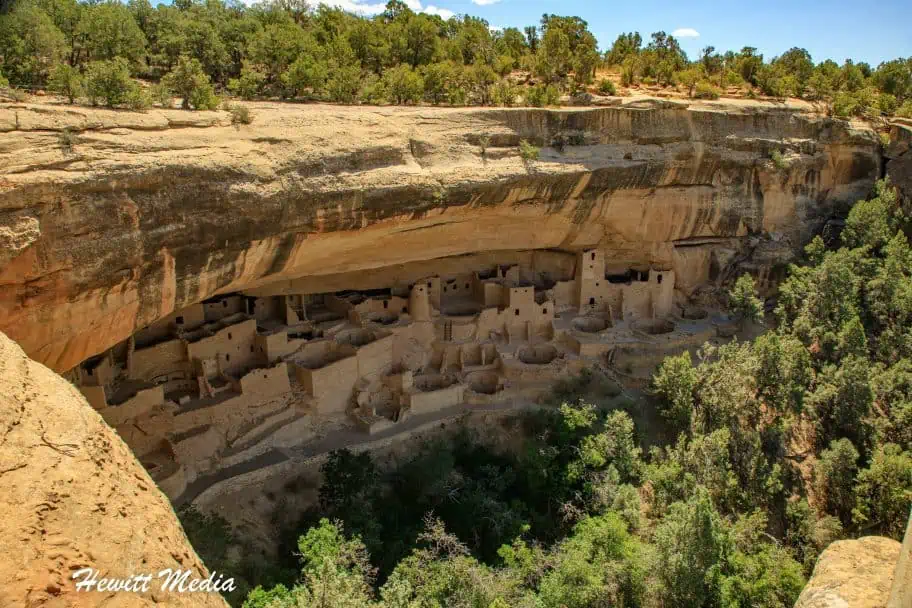
| Mesa Verde National Park | |
| READ MORE: | |
 |
|
| Zapata Falls | |
Where to Stay Near Rocky Mountain National Park

Campgrounds
When visiting the national parks and monuments of the United States, it is a really neat experience to camp out during your visit. Some of the best campgrounds in America can be found inside the country’s national parks and monuments and the surrounding areas.
If you are interested in camping out during your visit, I have included a map of some recommended campgrounds for you to review in my Rocky Mountain National Park Guide below.
Hotels
If camping is not your speed, you need not worry as there are a variety of good hotels for you to choose from in the area as well. If you are in the process of planning your trip to Rocky Mountain National Park and are looking for recommendations on hotels in the area, the closest city with hotel accommodations is Estes Park.
To assist you in finding a hotel that meets your needs, I have included a map and list of recommended hotels and different price points for you to review in my Rocky Mountain National Park Guide below.

| The Trail Ridge Road | |
| Longs Peak Trailhead | |
| The Alpine Visitor Center (Wildlife Viewing) | |
| Sprague Lake | |
| Bear Lake Nature Trail | |
| Emerald Lake | |
| Alberta Falls | |
| The Forest Canyon Overlook | |
| Chasm Lake | |
| Dream Lake |
Rocky Mountain National Park Resources

When planning any trip, you can never have too many resources at your disposal. In addition to the information I have provided you in this guide, I have linked to several other official resources from the US National Parks Service in my Rocky Mountain National Park Guide below for you to use to plan your trip as well.
- Fees and Passes
- Permits and Reservations
- Shuttle Bus Routes
- Park Maps
- Park Campground Info
- Scenic Drives
- Visitor Centers
- Nearby Attractions
- Park Plants and Animals
Activities Near Rocky Mountain National Park

There are a lot of beautiful and amazing things to see in Rocky Mountain National Park, but there are also a lot of really fun activities that you can do during your visit as well. If you are starting to plan your trip and are looking for some fun activities to enjoy while you are at the park, I have included some suggestions for you to review in my Rocky Mountain National Park Guide below.
Recommended Rocky Mountain National Park Tours
Rocky Mountain National Park Photo Gallery
In addition to being one of the most breathtaking mountain parks in the United States, Rocky Mountain National Park is also one of the most beautiful places in America for landscape photography. If you would like to see some of the many wonderful photographs that I have taken during my visits to Rocky Mountain National Park, please check out the photo gallery that I have included in my Rocky Mountain National Park Guide below.
If you’re interested in exploring more of my travel photography, I’d love for you to join me on Instagram! Creating this blog to share my free guides, itineraries, and travel photography tips takes a lot of effort, and a follow on Instagram would truly mean the world to me. Your support makes it all worthwhile!
FOLLOW ME!


Don’t Forget to Subscribe to My Adventures!

Let Me Help You Save On Your Next Adventure!
‘Start Exploring Today’ Merchandise Available Now!
 |
 |
 |
 |
 |
 |
 |


Wonderful guide, Josh. We stayed at Estes Park KOA and found it perfectly adequate. Would stay there again. My sister lives in Fort Collins and said parts of Estes Park were evacuated due to fire a while back. I do hope they escaped damage – RMNP, too.
I was super impressed with Estes Park! I had been to Rocky Mountain NP before, but never made it to the city. What a great location your sister lives in!!
Your first map in the article, showing the location of Rocky Mountain National Park on the national map, incorrectly shows it located in Wyoming. It should be one state further south, in Colorado.
Thank you Conrad. It has been updated. Much appreciated!