LAST UPDATED: 2/25/24 – Pinnacles National Park Guide
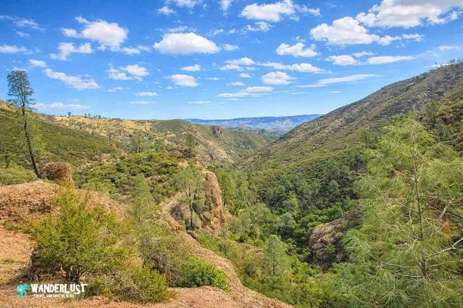
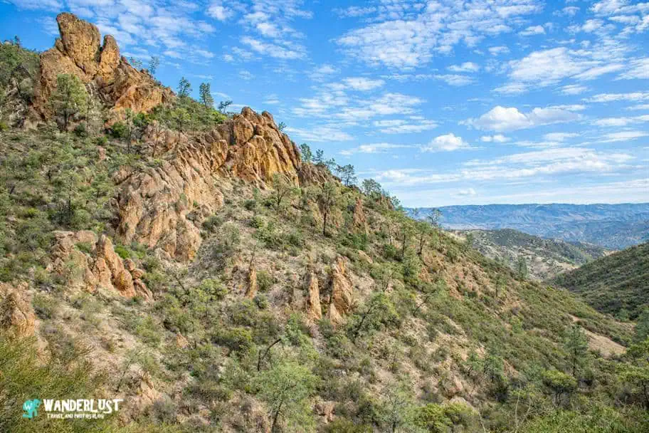
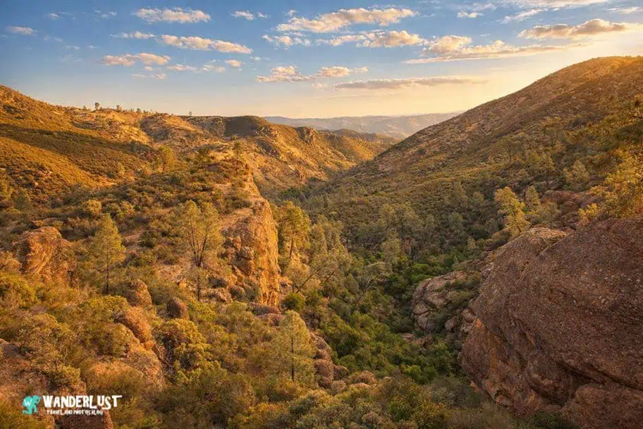
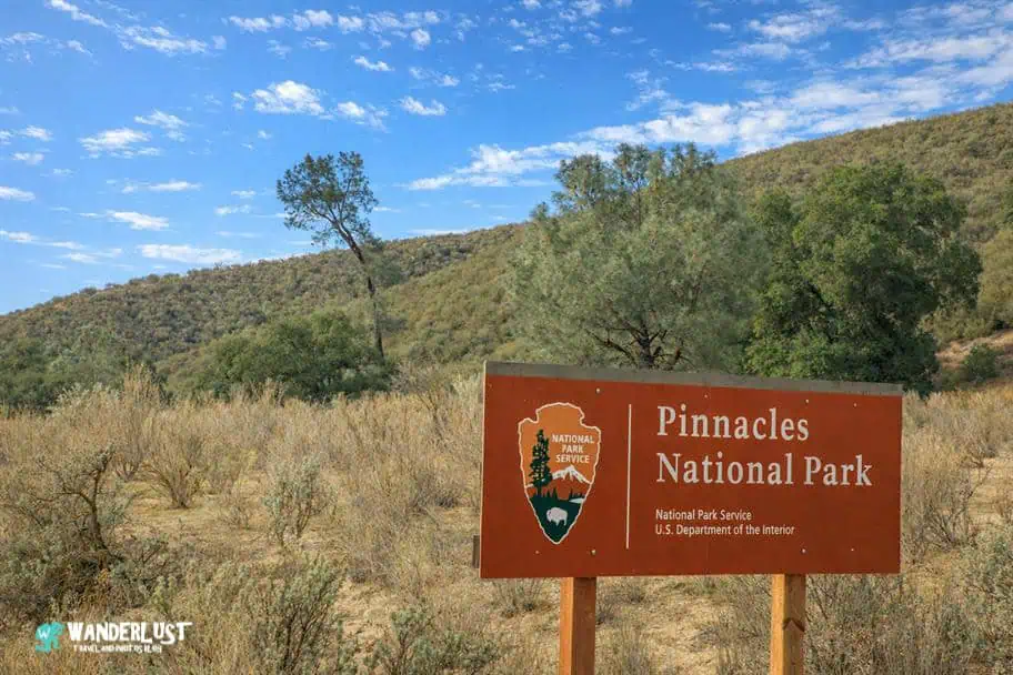
A landscape of jagged spires, hidden caves, and ancient volcanic formations makes Pinnacles one of the most dramatic and underrated national parks in California. This Pinnacles National Park guide introduces a place where condors soar overhead, talus caves invite exploration, and rugged trails wind through a world shaped by millions of years of geologic upheaval. Whether you’re drawn by the challenge of high‑country hikes or the quiet beauty of oak woodlands, Pinnacles offers an experience that feels both intimate and wild.

What makes Pinnacles especially compelling is the variety packed into a relatively small footprint. Travelers can climb to panoramic ridgelines, squeeze through shadowy cave passages, or watch wildlife thrive in a protected ecosystem that feels far removed from the busy Central Coast. These opening sections set the stage for a deeper look at what to see, how to plan your visit, and how to make the most of your time in one of California’s most distinctive national parks.
An All-You-Need Pinnacles National Park Guide
In this Pinnacles National Park guide, I am going to give you all of the information you need to plan a successful trip to see the park. I cover the best times to visit and the best ways to get there so that you can maximize what you can see and do on your trip. In addition, I outline the top things to see and do while you are there, and where the best places to stay and eat are. With this information in hand, you can be confident that your trip to Pinnacles National Park will be one that you remember for the rest of your life.
Pinnacles National Park Navigation Menu

How to Get to Pinnacles National Park

Pinnacles National Park is located in Central California, roughly 125 miles south of San Francisco and 268 miles north of Los Angeles. San Francisco is the closest major city with an airport, but the city of Santa Barbara to the south is also relatively close to the park and has a major airport you can fly into as well.
If you are planning a larger trip to California or the American Southwest and would like to include a stop at Pinnacles National Park on your itinerary, I have included a table below with the distances to the park from the major cities and other parks in the area for you to review in my Pinnacles National Park Guide below.
Drive Times to Pinnacles National Park
| City\Park | Distance | Drive Time | Notes |
|---|---|---|---|
| Monterey, CA (MRY) | 52 miles | 1hr 15min | Closest commercial airport; small but efficient; good for regional flights; scenic coastal city. |
| San Jose, CA (SJC) | 72 miles | 1hr 30min | Nearest major international airport; tech‑hub city with extensive flight options. |
| San Francisco, CA (SFO) | 103 miles | 2hrs | One of the largest West Coast international hubs; global connectivity; major tourist city. |
| Oakland, CA (OAK) | 96 miles | 1hr 50min | Large international airport with easier navigation than SFO; major Bay Area city. |
| Yosemite National Park | 150 miles | 3hrs 15min | Granite cliffs, waterfalls, and giant sequoias; one of America’s most iconic parks. |
| Sequoia National Park | 175 miles | 3hrs 30min | Home to the world’s largest trees; dramatic Sierra landscapes. |
| Kings Canyon National Park | 165 miles | 3hrs 20min | Deep glacial canyons, giant sequoias, and high Sierra wilderness. |
| Point Reyes National Seashore | 145 miles | 2hrs 50min | Rugged coastline, tule elk, and dramatic cliffs north of San Francisco. |
| Pfeiffer Big Sur State Park | 65 miles | 1hrs 35min | Redwoods and river canyon trails in the heart of Big Sur. |
| Fremont Peak State Park | 22 miles | 0hrs 45min | Mountain park with panoramic views of Monterey Bay; great for stargazing. |
| Julia Pfeiffer Burns State Park | 63 miles | 1hrs 40min | Home of McWay Falls; iconic Big Sur coastal scenery. |
| Big Basin Redwoods State Park | 70 miles | 1hrs 40min | California’s oldest state park; ancient redwoods; recovering from 2020 fires. |
| Channel Islands National Park | 236 miles | 4hrs 35min | Offshore national park accessed via Ventura Harbor; known for sea caves, island foxes, kayaking, and rugged coastal hikes. |
There Are Many Incredible Things to See in the Region
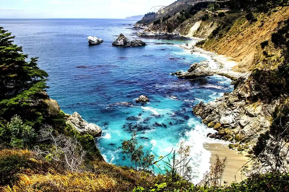
Pinnacles sits in the middle of a region packed with remarkable landscapes, and it’s easy to combine the park with other destinations in California and the Southwest. If you’re flying into San Francisco or Los Angeles, the coastal route makes an especially memorable approach, with Big Sur offering some of the most dramatic shoreline scenery in the United States.
Because the park’s East and West Entrances are not connected by road, it helps to look at the park map before you arrive so you can decide which side best matches what you want to see. The map in my Pinnacles National Park guide highlights the trail networks, parking areas, and major viewpoints, making it easier to choose your entrance and plan your time efficiently.
Use the East Entrance If You Aren’t Planning to Hike Much
Pro Tip: If you are not planning to do a lot of hiking within the park, but would like to see the rock formations and perhaps spot a California Condor, then I would recommend using the East entrance to the park. Using this entrance, it will be easy for you to access the trailhead for the Condor Gulch Trail, which is a relatively short and easy hike that has some great views of the pinnacles and gives you a great chance of spotting Condors.
Use the West Entrance If You Plan to Hike A Lot
If you are planning to do a fair amount of hiking within the park, then the West entrance might be the best choice for you. By using the West entrance, you can use the Chaparral parking area, which gives you close access to trails to both the Balconies and the High Peaks areas of the park.
If you are really adventurous, the park is small enough that it is possible to hike from the Eastern section of the park to the Western section of the park in one day. Please reference the “Top Things to See and Do” section of my Pinnacles National Park Guide below for more information on the top hikes I recommend within the park.

Top Things to See and Do in Pinnacles National Park

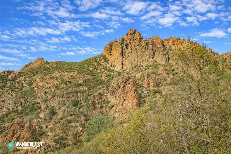
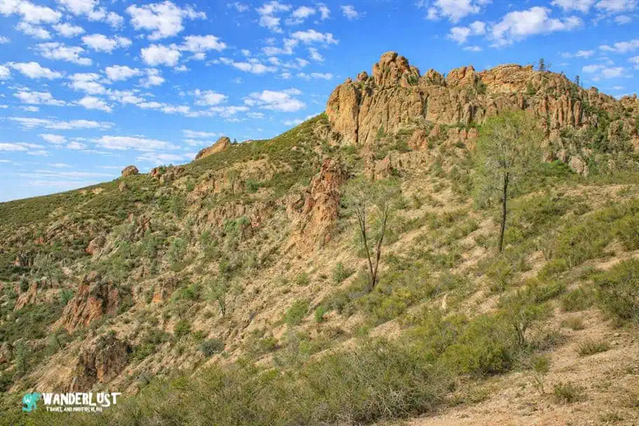
Pinnacles National Park may be small, but that doesn’t mean it is short of amazing things to see and do. In addition to being one of the best places in California to spot the rare and incredible California Condors, the park is also an excellent place for hiking, climbing, and nature-watching.
Pinnacles National Park has a wide variety of hiking trails of various difficulties, making it a great place for hikers of all abilities to come to explore. In addition, its amazing rock pinnacles provide some of the best climbing routes in Central California.
If you are looking for some ideas on what to do while visiting the park, I have included a list of my top things to see and do for you to review in my Pinnacles National Park Guide below.
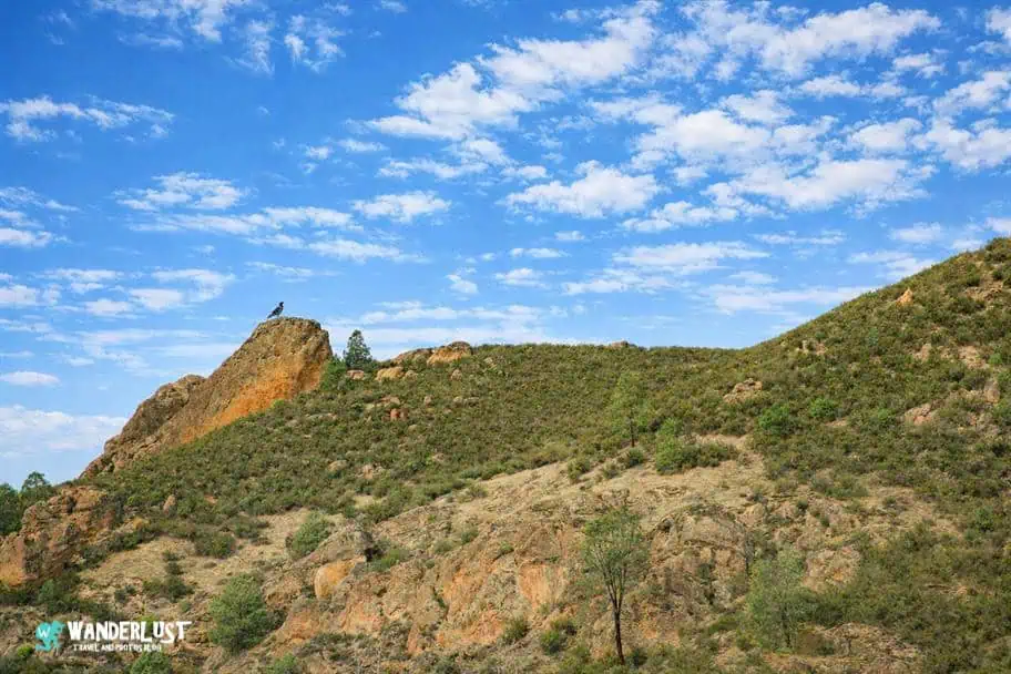
Spot a California Condor

California condors are one of Pinnacles’ biggest draws, and the park is one of the best places anywhere to see them. With wingspans reaching 10 feet, they nest in the rocky spires and often soar high above the valleys, making the higher trails your best chance for a close look.
The High Peaks Trail offers the strongest odds for experienced hikers, while the Condor Gulch Trail provides an easier option with good viewing potential. Many other raptors patrol the area as well, including prairie falcons, golden eagles, red‑tailed hawks, kestrels, and several hawk species. When scanning the sky, the condor’s distinctive white underwing patches make it easy to distinguish from other soaring birds.
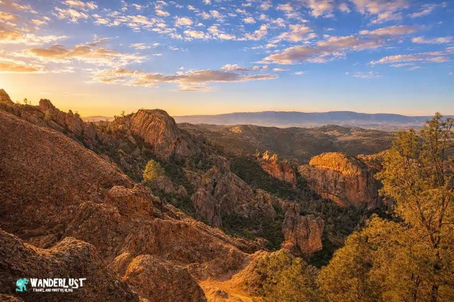
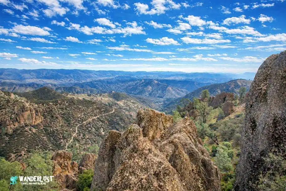
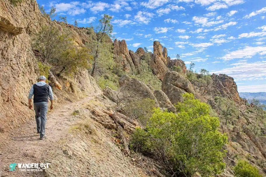
Hike the High Peaks Trail

If you are up for a hiking challenge, one of the best ways to see the park and spot California Condors during your stay in Pinnacles National Park is to hike the High Peaks Trail. It is a difficult hike with technical components, so it should only be attempted by hikers who are in relatively good shape, have adequate hiking boots or shoes, and have experience hiking on steep trails at high altitudes.
While the trial is challenging, the rewards are typically great. From the top of the high peaks, you have some of the best views of the pinnacles that the park is famous for. You also have a great chance of seeing a California Condor up close, as they like to nest in the rocky outcroppings within the pinnacles at high altitudes. If you would like to learn more about this challenging hike, I have included a map with the trail stats in my Pinnacles National Park Guide below for you to review.
High Peaks Trail Stats
| Trail Type: | Loop |
| Distance: | 13.4 miles/21.6 kilometers |
| Elevation Gain: | 3,254 feet/992 meters |
| Time to Complete: | 7.5 to 8 hours |
| Difficulty Level: | Difficult |
High Peaks Trail Map
Visit the Condor Gulch Overlook

If you would like to do a little hiking and have a good chance of spotting a California Condor up close, but don’t feel up to hiking the difficult High Peaks Trail, there is a good trail option I can recommend for less experienced hikers.
The Condor Gulch Trail is a relatively easy trail that takes you up to the foot of the high pinnacles but stops short of the steep ascent along the High Peaks Trail. The out-and-back hike from the Bear Gulch Day Use Area to the Condor Gulch Lookout is a great way for visitors of all hiking abilities to see California Condors within the park.
If you would like to learn more about this popular hike, I have included a map with the trail stats in my Pinnacles National Park Guide below for you to review.
Condor Gulch Overlook Trail Stats
| Trail Type: | Out-and-Back |
| Distance: | 2 miles/3.2 kilometers |
| Elevation Gain: | 531 feet/162 meters |
| Time to Complete: | 1 to 1.5 hours |
| Difficulty Level: | Moderate |
Condor Gulch Overlook Trail Map
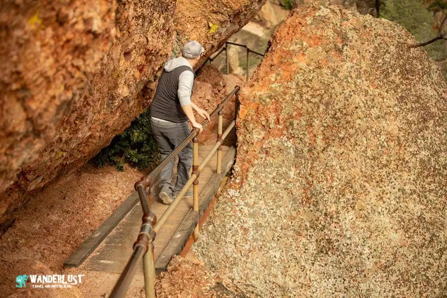
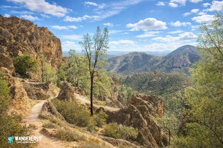
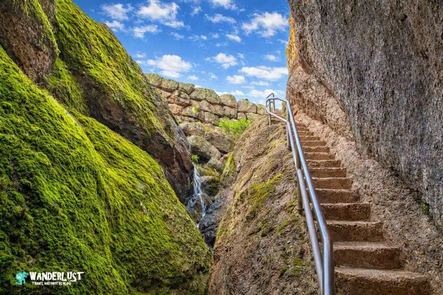
Explore the Bear Gulch Cave

Talus caves offer another distinctive experience inside the park, formed where massive fallen boulders roof over narrow canyons rather than creating traditional cavern systems. They’re some of the most unique landscapes in the region and a great contrast to the open high‑country views. The easiest of these to explore is Bear Gulch Cave, located near the Bear Gulch Day Use Area. Its location is marked in my Pinnacles National Park guide, which makes it simple to plan a quick stop during your visit.
Bear Gulch Cave Trail Stats
| Trail Type: | Out-and-Back |
| Distance: | 2.8 miles/4.5 kilometers |
| Elevation Gain: | 659 feet/201 meters |
| Time to Complete: | 1.5 to 2 hours |
| Difficulty Level: | Moderate |
Bear Gulch Cave Trail Map
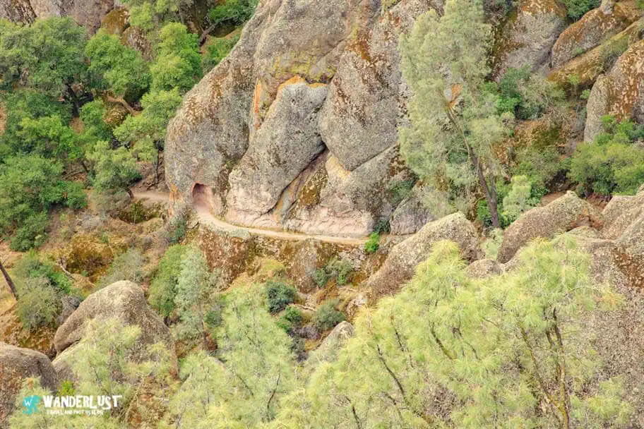
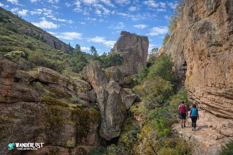
Explore the Balconies Cave

If you enter the park from the West, there is a relatively short hike that will take you to one of the more extraordinary caves located within the park. The Balconies Cave Trail is an easy-to-moderate hike that takes you along some fascinating cliffs in the high altitudes of Pinnacles National Park and through an amazing talus cave (pictured above).
If you are visiting the park from the East, it is still possible to hike to the cave via the High Peaks Trail, but it is a much longer and more difficult hike. If you are interested in seeing this neat cave during your visit, I have included a map of its location for you to review in my Pinnacles National Park Guide below.
Balconies Cave Trail Stats
| Trail Type: | Out-and-Back |
| Distance: | 2.7 miles/4.3 kilometers |
| Elevation Gain: | 383 feet/117 meters |
| Time to Complete: | 1 to 2 hours |
| Difficulty Level: | Moderate |
Balconies Cave Trail Map
Hike the Chalone Peak Trail

It seems the higher you climb in Pinnacles National Park, the more breathtaking the views become. If you would like to see the ultimate view from the top of the park, then I would recommend you consider hiking to the top of the Chalone Peaks.
It is not an easy hike, so if you aren’t in good condition and don’t have a lot of hiking experience, you may not want to attempt this hike. However, if you are up to the challenge, the payoff from reaching the peaks is amazing.
There are two peaks on this hike, the North Chalone Peak and the South Chalone Peak. The out-and-back trail takes you to both, or you can hike to the north peak (which is the higher of the two peaks) and turn around there. For those interested, I have included a trail map for you to review in my Pinnacles National Park Guide below.
Chalone Peak Trail Stats
| Trail Type: | Out-and-Back |
| Distance: | 7.9 miles/12.7 kilometers |
| Elevation Gain: | 2,158 feet/658 meters |
| Time to Complete: | 4.5 to 5 hours |
| Difficulty Level: | Difficult |
Chalone Peak Trail Map
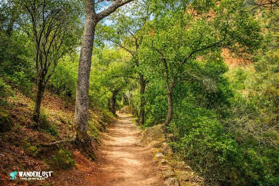
Hike the Moses Spring Trail

If you are up for doing some hiking while visiting Pinnacles National Park but aren’t interested in some of the more difficult hikes that take you to the park’s higher altitudes, one of the best hikes that I can recommend is the Moses Spring Trail hike.
This relatively short and easy hike takes you through some very interesting rock formations, tunnels, and talus caves on your way to the Bear Gulch Reservoir. You are less likely to see California Condors on this trail, but it isn’t unheard of.
More likely, you will see some of the other bird species that frequent the park. If you would like to learn more about this popular hike, I have included a map with the trail stats in my Pinnacles National Park Guide below for you to review.
Moses Spring Trail Stats
| Trail Type: | Loop |
| Distance: | 2 miles/3.2 kilometers |
| Elevation Gain: | 439 feet/134 meters |
| Time to Complete: | 1 to 1.5 hours |
| Difficulty Level: | Moderate |
Moses Spring Trail Map
Go Rock Climbing

Considering the number of towering rock formations that can be found in the park, it will probably not come as a surprise to you when I say that Pinnacles National Park is one of the best places for rock climbing in Central California.
Numerous mapped climbing routes can be found throughout the park, many of which are marked by signs to make them easy to locate. If you don’t have a lot of experience rock climbing but would like to learn, I suggest you check out the tours and excursions section of my Pinnacles National Park Guide below for some recommendations on rock climbing tours that you can take advantage of.
Explore Bear Gulch Reservoir

While the rock formations and the talus caves are breathtaking, one of my favorite spots to photograph within Pinnacles National Park is undoubtedly the Bear Gulch Reservoir. In addition to being breathtakingly beautiful, it is also a great place to spot wildlife.
There are several hikes that I have outlined in this guide that take you by the reservoir, including the short Moses Spring Trail hike. I would strongly suggest not leaving the park until you have had a chance to stop by the reservoir and take some photographs.
Tunnel Trail

The last trail that I want to outline for you in my Pinnacles National Park Guide may be one of the most interesting trails in the park. Many trail tunnels pass through the rock pinnacles within the park, but some of the most amazing of these tunnels are on a trail that is appropriately named the Tunnel Trail.
This trail is located at high elevation and is accessible from the Eastern section of the park via the High Peaks Trail and from the Western section of the park using the Juniper Canyon Trail.
Getting to the trail isn’t easy from either side, but if you are looking for the easiest path to this trail, I would recommend approaching from the West. If you would like to learn more about this popular hike, I have included a map with the trail stats in my Pinnacles National Park Guide below for you to review.

Best Times to Visit Pinnacles National Park

Average Temperature (°F)
Pinnacles National Park is located in Central California, so the weather in the park typically doesn’t get too hot or too cold throughout the year. During the winter months of December through February, you will likely see low temperatures that dip into the 40s.
If this is too chilly for you, then you will want to avoid visiting during the winter. High temperatures don’t get too hot during the summer months of June through August, but it isn’t unheard of to see temperatures reach into the 90s.
Average Precipitation (Inches)
In my opinion, the most important factor that you should consider when planning your trip to Pinnacles National Park is the amount of precipitation. This area of California is prone to mudslides when it rains too much, and it isn’t unusual to have certain roads and trails within the park close when the weather gets too wet.
In fact, there have been years where trail bridges have been washed away because of the heavy rains. For this reason, I would strongly suggest avoiding the months of November through March when planning your visit. These are typically the wettest months in the park and there is a great likelihood that rain will prevent you from enjoying the park during this time of year.
Average Visitors (Visitors Per Day)
Another important factor that you will want to consider when planning your trip to Pinnacles National Park is the number of other visitors at the park. Pinnacles is one of the most underrated parks in America’s National Park System, so the crowds typically don’t get as big as you see in some of the other more popular parks in California.
However, there are certain times of the year when the trails will be busier than usual. If you are looking to avoid the crowds as much as possible, I would steer clear of visiting during March through May. This is typically the busiest time of the year for Pinnacles National Park.
Other Things to See in the Area

The state of California has some of the most beautiful landscapes in North America, and the Central California region where Pinnacles National Park is located is no exception. There is no shortage of amazing things to see and do in the area, that’s for sure.
If you are planning an extended trip to Central California and are looking for some additional stops to add to your itinerary after you have visited Pinnacles National Park, I have included links to some guides that you might find interesting below.
| READ MORE: |
 |
| Big Sur Travel Guide |
| READ MORE: |
 |
| Muir Woods National Monument and San Francisco Guide |
| READ MORE: |
 |
| Joshua Tree National Park Visitor Guide |
Where to Stay Near Pinnacles National Park

Campgrounds
When visiting the national parks and monuments of the United States, it is a really neat experience to camp out during your visit. Some of the best campgrounds in America can be found inside the country’s national parks and monuments and the surrounding areas.
If you are interested in camping out during your visit, I have included a map of some recommended campgrounds for you to review below.
Hotels
If camping is not your speed, you need not work as there are a variety of good hotels for you to choose from in the area as well. If you are in the process of planning your trip to Pinnacles National Park and are looking for recommendations on hotels in the area, I have included a map and list of recommended hotels and different price points for you to review below.

Pinnacles National Park Resources

When planning any trip, you can never have too many resources at your disposal. In addition to the information I have provided you in this guide, I have linked to several other official resources from the US National Parks Service below for you to use to plan your trip as well.
- Operating Hours and Seasons
- Fees and Passes
- Permits and Reservations
- Park Map
- Park Campgrounds
- Places to Go
- Park Trails
- Talus Caves
- Park Climbing
- Bird Watching
- Park Plants and Animals
Activities in the Pinnacles National Park Area

Pinnacles National Park is a beautiful place and there are plenty of great things to see and do inside the park. However, it isn’t the only amazing thing to see in this part of California. If you are going to be in the area for a few days and are looking for some activities to add to your agenda, I have included links to some of the more popular tours and excursions in the area for you to review below.
Recommended Tours from Monterey and Carmel by the Sea
Pinnacles National Park Photo Gallery
Pinnacles National Park is a very beautiful and picturesque place. If you are interested in seeing more of this beautiful park, I have included some of my favorite photographs that I have taken during my visits to a gallery for you to review below.
If you’re interested in exploring more of my travel photography, I’d love for you to join me on Instagram! Creating this blog to share my free guides, itineraries, and travel photography tips takes a lot of effort, and a follow on Instagram would truly mean the world to me. Your support makes it all worthwhile!
FOLLOW ME!


Don’t Forget to Subscribe to My Adventures!

Let Me Help You Save On Your Next Adventure!
‘Start Exploring Today’ Merchandise Available Now!
 |
 |
 |
 |
 |
 |
 |


Looks beautiful. Thanks for the introduction.
You are most welcome! 😀