LAST UPDATED 3/25/26 – Most Beautiful Day Hikes in the World for Adventure Travelers
For some people, sitting back and relaxing while traveling is just not in their DNA. I know that I am one of these people. When I travel, I always have to be doing something active. Depending on where I am traveling, it is typically kayaking, snorkeling, scuba diving, sky diving, or my favorite travel activity, which is hiking.
For me, there is no better way to appreciate the beauty of an area than to hike through some of its most breathtaking landscapes. In fact, I love hiking so much that sometimes I will plan an entire trip around one of the most beautiful day hikes on my bucket list.

If you are like me and love to seek adventure when you travel, especially the most beautiful day hikes in the world, then you are in luck. In this article, I am going to share with you my list of the 20 Most Beautiful Day Hikes in the World for Adventure Travelers to Conquer. These hikes involve some of the most beautiful landscapes and difficult trails in the world.
When you combine breathtaking scenery with a challenging trail, you get some of the most epic hiking experiences you can imagine. So before you start planning your next travel adventure, take a look at my list of the top day hikes for adventure travelers for some inspiration.

| READ MORE: | |
 |
|
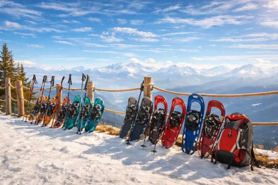
| Snowshoe Gear Guide for Adventure Travelers |
20. Queens Garden\Navajo Loop
Bryce Canyon NP, Utah, USA

The first hike on my list is located in one of my favorite national parks in the United States. While the Queens Garden and Navajo Loop combination trail isn’t the most difficult hike you will find on my list, it may be one of the most beautiful. If you aren’t familiar with Bryce Canyon, be sure to check out my Bryce Canyon National Park Visitor Guide linked below.
It is one of the most spectacular landscapes you will find anywhere in the world. The canyon is filled with hoodoos, which are interesting rock spires that stick up from the canyon floor. Hiking through these unique and beautiful rock formations is like hiking on another planet. This is why the Queen’s Garden and Navajo Loop trail makes it onto my list of the top day hikes in the world.
| READ MORE: | |
 |
|
| Bryce Canyon National Park Visitor Guide |
Queens Garden\Navajo Loop Trail Stats
| Trail Type: | Loop |
| Distance: | 3 miles/4.8 kilometers |
| Elevation Gain: | 646 feet/197 meters |
| Time to Complete: | 1.5 to 2 hours |
| Difficulty Level: | Moderate |
Queens Garden\Navajo Loop Trail Map
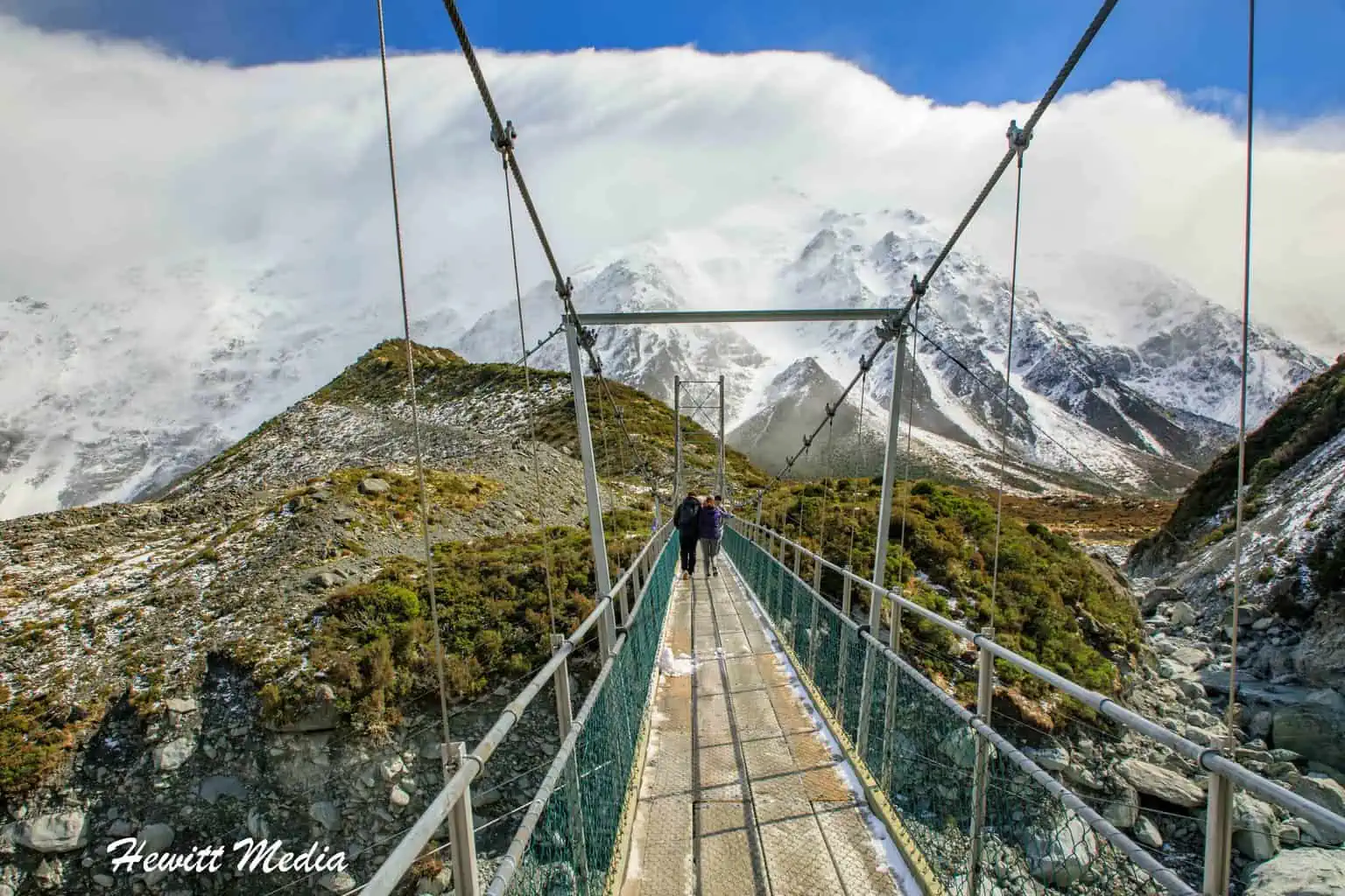
19. Hooker Valley Track
Mount Cook NP, New Zealand

The next hike on my list of the top day hikes in the world for adventure travelers may come as a surprise to the hiking enthusiasts out there. If you were to ask most hiking enthusiasts which hike they think is the most notable hike within Aoraki\Mount Cook National Park in New Zealand, I doubt a majority would say that the Hooker Valley Track is at the top of their list. My guess is that the park’s more difficult hikes, such as the Sealy Tarns Track or the Mueller Hut Track, would get a majority of the votes.
Don’t get me wrong, those are amazing hikes. However, they are also considerably more difficult than the Hooker Valley Track, which is a fantastic hiking track in its own right. The beauty of the scenery and the accessibility of the track are what made me decide to include the Hooker Valley Track on my list.
After all, it is not often that you see a hiking track with three legitimate suspension bridges for you to cross. For more information on this amazing hiking track and the other incredible tracks within the park, please review my Aoraki Mount Cook National Park Visitor Guide, which I linked to below.
Hooker Valley Track Trail Stats
| Trail Type: | Out-and-Back |
| Distance: | 6.8 miles/10.9 kilometers |
| Elevation Gain: | 702 feet/214 meters |
| Time to Complete: | 2.5 to 3 hours |
| Difficulty Level: | Moderate |
Hooker Valley Track Trail Map
18. Queenstown Hill Hike
Queenstown, New Zealand

The next hike on my list is located in one of my favorite cities in New Zealand, if not the entire world. I absolutely love mountain destinations, and I cannot think of a more beautiful mountain destination than Queenstown on New Zealand’s South Island. The South Island is chock-full of beautiful mountain vistas and incredible alpine hikes, and Queenstown certainly has its fair share of them. Known worldwide as the adventure capital of the world, Queenstown is a city where you don’t have to look far or long for adventure.
For those with an urge to have an adventure, but perhaps don’t have the hiking chops to tackle one of the harder hikes on my list, then the Queenstown Hill hike may be just what you are looking for. Rated as a moderately difficult hike, Queenstown Hill can be tackled by anyone who is moderately in shape, regardless of their hiking experience.
There aren’t any really steep or technically challenging sections, but the incline is fairly sustained for stretches. If you have the time to go at your own pace and take your time, you can knock off this hike and be rewarded with some of the most amazing views you will see at the end of a hike.

Queenstown Hill Walkway Trail Stats
| Trail Type: | Out-and-Back |
| Distance: | 3.1 miles/5 kilometers |
| Elevation Gain: | 1,309 feet/399 meters |
| Time to Complete: | 2 to 2.5 hours |
| Difficulty Level: | Difficult |
Queenstown Hill Walkway Trail Map
17. Preikestolen (Pulpit Rock)
Jørpeland, Norway
")
Preikestolen, or Pulpit Rock, is one of Norway’s most breathtaking natural wonders, rising 604 meters above the Lysefjord. The 8‑kilometer round‑trip trail begins near the Preikestolen Mountain Lodge and winds through forests, rocky climbs, and scenic overlooks. It’s considered one of the country’s most beautiful day hikes, offering a rewarding blend of challenge and accessibility that typically takes 4–5 hours to complete. Reaching the summit reveals a wide, flat cliff with sweeping views of the fjord and surrounding mountains.
Sunrise is an especially enchanting time to be there, as warm light spills across the water and illuminates the rugged landscape. Although the plateau is spacious, there are no guardrails, so hikers should be mindful near the edge. The trail is best tackled between April and October when conditions are safest. Whether you’re seeking adventure, tranquility, or simply an unforgettable view, the Preikestolen hike delivers a spectacular encounter with Norway’s fjord country.
Preikestolen Trail Stats
| Trail Type: | Out-and-Back |
| Distance: | 5.2 miles/8.4 kilometers |
| Elevation Gain: | 1,427 feet/435 meters |
| Time to Complete: | 4 to 5 hours |
| Difficulty Level: | Moderate |
Preikestolen Trail Map
16. Mount Batur Sunrise Hike
Bali, Indonesia

The Mount Batur sunrise hike in Bali is a rewarding early morning trek that begins in darkness and ends with a spectacular view. The trail climbs to 1,717 meters through volcanic terrain, taking about two hours to reach the summit. As the sun rises over Mount Agung and Lake Batur, the sky glows with warm hues, casting light across the misty caldera and distant peaks.
Widely considered one of Bali’s most beautiful day hikes, it offers more than just a sunrise. Hikers often enjoy breakfast cooked over geothermal steam vents and take in views of the surrounding villages and lush landscape during the descent. It’s a memorable way to start the day, blending natural beauty, cultural charm, and a sense of adventure.
Mount Batur Sunrise Hike Trail Stats
| Trail Type: | Out-and-Back |
| Distance: | 5.6 miles/9 kilometers |
| Elevation Gain: | 2,217 feet/676 meters |
| Time to Complete: | 3 to 4 hours |
| Difficulty Level: | Difficult |
Mount Batur Sunrise Hike Trail Map
15. Table Mountain (Platteklip Gorge)
Cape Town, South Africa

The Platteklip Gorge hike to Table Mountain’s upper cable station is one of Cape Town’s most direct summit routes. Starting near Tafelberg Road, it climbs steeply through a rocky gorge, gaining over 700 meters in just under 3 kilometers. The path is rugged and demanding, but the views of the city and coastline grow more impressive with every step.
Often listed among South Africa’s most beautiful day hikes, Platteklip Gorge offers a rewarding challenge and sweeping summit vistas. Once at the top, hikers can descend via cable car or explore the plateau. Early starts help avoid heat and crowds, and sturdy shoes are essential for the uneven terrain.
| READ MORE: |
 |
| The Ultimate Cape Town Travel Guide |
Table Mountain Trail Stats
| Trail Type: | Out-and-Back |
| Distance: | 3.6 miles/5.8 kilometers |
| Elevation Gain: | 2,457 feet/749 meters |
| Time to Complete: | 1.5 to 3 hours |
| Difficulty Level: | Difficult |
Table Mountain Trail Map
14. Tre Cime di Lavaredo Loop
The Dolomites, Italy

The next trail on my list is one of the most acclaimed hiking tracks in all of Europe. When it comes to challenging and beautiful trails, the Tre Cime di Lavaredo loop is among the most beautiful and most challenging. The trail draws hikers from around the world each year to test themselves against the trail and enjoy the jagged limestone peaks and stunning views of the Italian Dolomites.
Once on the trail, you will be mesmerized by the beautiful panoramic mountain vistas as you traverse rocky ledges, high alpine meadows, and steep slopes along this famous alpine trail. If you decide to do this hike, make sure you pack a camera because you will want to photograph the amazing scenery you see.
Tre Cime di Lavaredo Loop Trail Stats
| Trail Type: | Loop |
| Distance: | 4.3 miles/6.9 kilometers |
| Elevation Gain: | 1 feet/0 meters |
| Time to Complete: | 3 to 5 hours |
| Difficulty Level: | Moderate |
Tre Cime di Lavaredo Loop Trail Map
13. The Narrows Hike (Bottom-Up)
Zion NP, Utah, USA
")
The next trail on my list is the Narrows Hike in the Zion National Park in the American Southwest state of Utah. Not only is the Narrows hike widely considered to be one of the most unique hiking trails in the US National Parks System, but it may also be one of the prettiest hikes in the park system as well.
While most hiking tracks cover ground, the Narrows Hike is almost exclusively in the water. The vast majority of the hike is up the Virgin River between some of Zion National Park’s most magnificent slot canyons. It’s not often that you get to hike up a river with stone walls that are hundreds of feet high on both sides of you.
It’s Important to Plan Ahead
If you are going to hike the Narrows Hike in Zion, I would make sure to plan ahead. You can hike the trail from the bottom up without a permit in one day, but the hike from the top down is much longer and requires a backcountry camping permit to complete. The hike is difficult enough in low currents, but when the water levels of the Virgin River are high, the hike can be downright dangerous.
The Park Services will close down the trail if the water levels get too high, so make sure you monitor the situation for the park service before setting off for your hike. To make things more comfortable, several outfitters in the area will rent you special shoes, wet or dry suits, and hiking poles to make the hike safer and more comfortable. For more information on the Narrows trail in Zion and how to rent gear, please check out my Zion National Park Visitor Guide linked below.
| READ MORE: | |
 |
|
| Zion National Park Visitor Guide |
The Narrows Bottom-Up Trail Stats
| Trail Type: | Out-and-Back |
| Distance: | 9.1 miles/14.6 kilometers |
| Elevation Gain: | 695 feet/212 meters |
| Time to Complete: | 4 to 8 hours |
| Difficulty Level: | Difficult |
The Narrows Bottom-Up Trail Map
12. Isthmus Peak Hike
Wanaka, New Zealand

The Isthmus Peak on New Zealand’s South Island is one of the most stunning and challenging hikes that I have undertaken during my travels, and one of the hikes that I look back on the most fondly. Located outside the famed hiking destination of Wanaka, New Zealand, the Isthmus Peak Track is often overshadowed by the far more acclaimed Roy’s Peak Track, which is located just on the other side of Lake Wanaka from the Isthmus Peak. Like its neighbor, Roy’s Peak, Isthmus Peak rewards hikers who reach its summit with some of the most jaw-droppingly beautiful vistas you can imagine.
Before you set off on this hike, please be aware that this hike is rated as difficult for a reason. Although it isn’t as technical or as dangerous as some of the other hikes on this list, it isn’t without its dangers. The track is very long and very steep and can be a relentless challenge for beginning hikers.
If you plan to complete this hike, I would make sure you check the weather, dress in layers to be prepared, pack enough food and snacks for the trail, and start off early in the morning to ensure that you are back down by nightfall. If you plan ahead and give yourself enough time, you can complete this hike and will be so very happy you did when you reach the top and see the views!

Isthmus Peak Track Trail Stats
| Trail Type: | Out-and-Back |
| Distance: | 10 miles/16.1 kilometers |
| Elevation Gain: | 3,713 feet/1,132 meters |
| Time to Complete: | 5 to 7 hours |
| Difficulty Level: | Difficult |
Isthmus Peak Track Trail Map
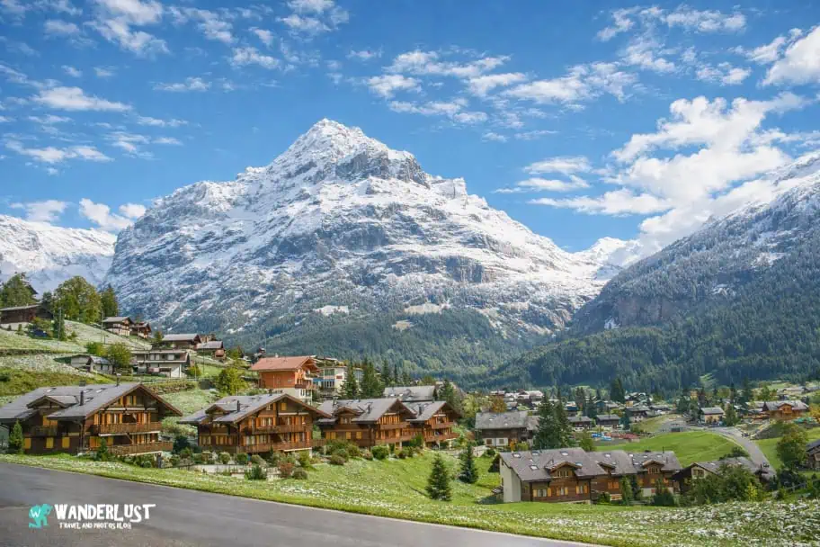
11. The Five Lakes Trail
Zermatt, Switzerland

The Five Lakes Trail in Zermatt is a scenic loop that showcases the serene beauty of the Swiss Alps. This moderate hike winds past five crystal-clear alpine lakes—Stellisee, Grindjisee, Grünsee, Moosjisee, and Leisee—each offering unique reflections of the Matterhorn and surrounding peaks. The trail stretches about 6.7 miles with gentle elevation changes, making it accessible for most hikers and ideal for a relaxed half-day adventure.
Often considered one of Switzerland’s most beautiful day hikes, the Five Lakes Trail blends tranquil waters, wildflower meadows, and panoramic mountain views. Along the way, hikers encounter grazing sheep, quiet forest patches, and picnic spots perfect for soaking in the alpine atmosphere. It’s a trail that invites you to slow down, take in the scenery, and enjoy the peaceful rhythm of the mountains.
| READ MORE: | |
 |
|
| Visitor’s Guide to Zermatt, Switzerland |
The Five Lakes Trail Stats
| Trail Type: | Point-to-Point |
| Distance: | 6.7 miles/10.8 kilometers |
| Elevation Gain: | 948 feet/289 meters |
| Time to Complete: | 3.5 to 4 hours |
| Difficulty Level: | Moderate |
The Five Lakes Trail Map
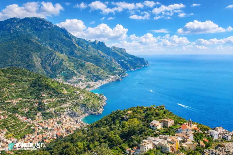
10. Path of the Gods (Sentiero degli Dei)
The Amalfi Coast, Italy
")
The Path of the Gods trail along Italy’s Amalfi Coast is a breathtaking hike that clings to the cliffs high above the Mediterranean. Starting near Bomerano and ending in Nocelle, the trail offers sweeping views of the coastline, terraced vineyards, and pastel-colored villages tucked into the hillsides. The route is moderately challenging, with rocky paths and occasional steep sections, but the scenery more than compensates for the effort.
Widely regarded as one of Europe’s most beautiful day hikes, this trail immerses you in the drama of the Amalfi landscape. The combination of sea views, fragrant wildflowers, and ancient mule tracks creates a timeless atmosphere. Hikers often pause to admire Positano in the distance or enjoy a quiet moment overlooking the shimmering blue sea. It’s a hike that blends natural beauty with cultural charm.
| READ MORE: |
 |
| Amalfi Coast, Italy Visitor Guide |
Path of the Gods Trail Stats
| Trail Type: | Point-to-Point |
| Distance: | 5.3 miles/8.5 kilometers |
| Elevation Gain: | 882 feet/269 meters |
| Time to Complete: | 3.5 to 4 hours |
| Difficulty Level: | Moderate |
Path of the Gods Trail Map
9. Múlagljúfur Canyon Hike
Vik, Iceland

The Múlagljúfur Canyon hike in southeast Iceland is a hidden gem that rewards adventurous hikers with dramatic views of glacial valleys, towering cliffs, and cascading waterfalls. The trail begins near the Ring Road and climbs steadily through moss-covered terrain, eventually revealing the deep canyon carved by glacial meltwater. Along the way, hikers are treated to panoramic vistas of Fjallsárlón Glacier Lagoon and the surrounding peaks.
Often described as one of Iceland’s most beautiful day hikes, Múlagljúfur offers a rare blend of solitude and raw natural beauty. The trail is relatively short but steep, making it ideal for those seeking a half-day challenge with unforgettable scenery. With its surreal landscapes and minimal crowds, this hike captures the essence of Iceland’s wild and untouched terrain.

Múlagljúfur Canyon Trail Stats
| Trail Type: | Out-and-Back |
| Distance: | 4.4 miles/7.1 kilometers |
| Elevation Gain: | 1,250 feet/381 meters |
| Time to Complete: | 2.5 to 3 hours |
| Difficulty Level: | Moderate |
Múlagljúfur Canyon Trail Map
8. Half Dome Hike
Yosemite NP, California, USA

The Half Dome hike in Yosemite National Park is one of the most iconic and challenging day hikes in the United States. Spanning roughly 14 to 16 miles round-trip, the trail begins in Yosemite Valley and climbs through forested switchbacks, past Vernal and Nevada Falls, and into the subalpine wilderness. The final stretch of the hike is what sets it apart: a steep ascent up the granite shoulder of Half Dome, culminating in the famous cables section.

This chains segment is a thrilling finale, where hikers use metal cables and wooden planks to climb the nearly vertical granite face. The exposed route demands physical strength, mental focus, and a good grip, especially in dry conditions. Once at the summit, the reward is a panoramic view of Yosemite’s peaks and valleys that feels both earned and unforgettable. Permits are required for the cable section, and the hike is best tackled early in the day to avoid crowds and afternoon storms.
Half Dome Hike Trail Stats
| Trail Type: | Out-and-Back |
| Distance: | 17.2 miles/27.7 kilometers |
| Elevation Gain: | 5,305 feet/1,617 meters |
| Time to Complete: | 10 to 16 hours |
| Difficulty Level: | Very Difficult |
Half Dome Hike Trail Map
7. Mount Fuji – Yoshida Trail (Japan)
Yamanashi Prefecture, Japan
")
The Mount Fuji – Yoshida Trail is the most popular route to Japan’s highest peak, offering a well-marked path that begins near the Fuji-Subaru Line 5th Station. As hikers ascend through volcanic terrain, they pass a series of mountain huts and torii gates, with views expanding over the surrounding forests and valleys. The trail is steep and rocky, but the cultural landmarks and sunrise vistas make the effort worthwhile.
Among Japan’s most beautiful day hikes, the Yoshida Trail combines natural grandeur with spiritual significance. The final stretch toward the summit reveals sweeping views above the clouds, and on clear mornings, hikers can witness the famed “Goraiko” sunrise. Though the trail is accessible during the official climbing season from July to early September, preparation and proper gear are essential due to the altitude and changing weather.
Yoshida Trail from 5th Station Stats
| Trail Type: | Point-to-Point |
| Distance: | 4.2 miles/6.8 kilometers |
| Elevation Gain: | 4,701 feet/1,433 meters |
| Time to Complete: | 4 to 4.5 hours |
| Difficulty Level: | Difficult |
Yoshida Trail from 5th Station Map
6. Tiger’s Nest Hike
Taktsang Trail, Bhutan

The Tiger’s Nest Trail in Bhutan is a spiritual and scenic journey that leads to the iconic Paro Taktsang Monastery, perched dramatically on a cliffside over 3,000 feet above the valley floor. The trail begins with a forested ascent through pine trees draped in prayer flags, gradually revealing sweeping views of the Paro Valley. Along the way, hikers pass small shrines and rest stops, with the monastery coming into view as a white-and-red structure clinging impossibly to the rock face.
Considered one of the Himalayas’ most beautiful day hikes, the Tiger’s Nest Trail blends cultural reverence with natural grandeur. The final stretch includes stone steps and narrow paths carved into the cliff, culminating in a visit to the sacred monastery itself. The hike is moderately challenging due to the elevation gain, but the reward is a profound sense of peace and awe at both the architectural feat and the surrounding landscape.
Tiger’s Nest Trail Stats
| Trail Type: | Out-and-Back |
| Distance: | 4.2 miles/6.8 kilometers |
| Elevation Gain: | 2,257 feet/688 meters |
| Time to Complete: | 3.5 to 4 hours |
| Difficulty Level: |
Tiger’s Next Trail Map
5. Torres del Paine Viewpoint
Torres del Paine NP, Chile

Some destinations in this world are so incredibly beautiful and wild that almost every hike at those locations is worthy of mention on any list of the world’s best hikes. Without a doubt, the Patagonia Region of South America is one of those locations. One of the places in Patagonia where this beauty is on full display is the Torres del Paine National Park in Chile. World-renowned for its vast plains, beautiful glacial-fed lakes, and spectacular mountain range, the Torres del Paine National Park has been captivating visitors for decades.
There are many amazing hikes that you can take within Torres del Paine, some of which are day hikes and some of which are multi-day hikes that take you further into the backcountry. One of the most popular day hikes in the park is the out-and-back hike to the Torres del Paine viewpoint.
It’s a long and difficult hike with quite a bit of elevation gain, but if you can make it to the end, you will be treated to one of the most incredible views you will find at the end of any hike. You will be treated to an amazing view of the jagged peaks that make Torres del Paine National Park so popular around the world. Make sure to bring a camera because you won’t want to forget this hike or the views you see along the way.
Torres del Paine viewpoint via Las Torres Trail Stats
| Trail Type: | Out-and-Back |
| Distance: | 12.8 miles/20.6 kilometers |
| Elevation Gain: | 3,366 feet/1,026 meters |
| Time to Complete: | 7 to 10 hours |
| Difficulty Level: | Difficult |
Torres del Paine viewpoint via Las Torres Trail Map
4. Ben Nevis Mountain Track
The Scottish Highlands, Scotland

The Ben Nevis Mountain Track, also called the Tourist Route, is the most popular way to reach the summit of Ben Nevis, the tallest mountain in the UK. Starting near Fort William, the path climbs steadily through grassy slopes and rocky terrain, offering stunning views of the Scottish Highlands.
Often considered one of the most beautiful day hikes in Scotland, the trail rewards hikers with panoramic vistas, especially on clear days. Though the route is well-marked and accessible, the weather can shift quickly, so preparation is essential for a safe and memorable adventure.
Ben Nevis Mountain Track Trail Stats
| Trail Type: | Out-and-Back |
| Distance: | 10.2 miles/16.4 kilometers |
| Elevation Gain: | 4,399 feet/1,341 meters |
| Time to Complete: | 7 to 9 hours |
| Difficulty Level: | Difficult |
Ben Nevis Mountain Track Trail Map
| READ MORE: | |
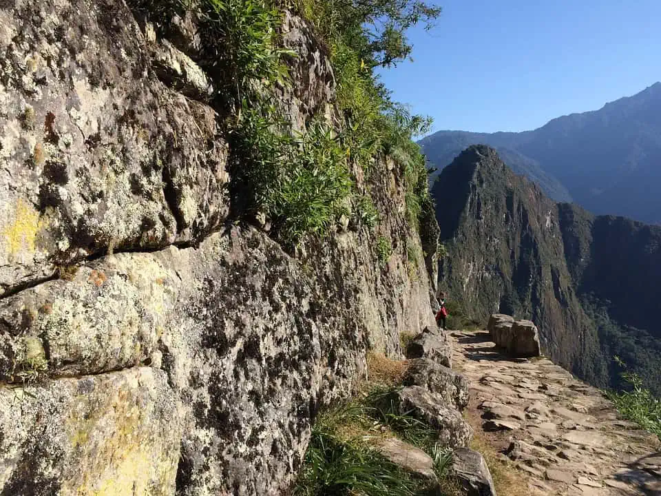 |
|
| The Ultimate Guide to Hiking the Inca Trail |
3. Trolltunga
Røldal, Norway

If you are a fan of hiking pictures on Instagram, I can think of no Instagram pictures that are more epic than the pictures you see of people standing on the rock ledge on the Trolltunga hike in Norway with the beautiful lake and mountains in the background. If I didn’t know this place was real, I would have a hard time believing that these pictures weren’t conjured up with some sophisticated photo editing software. I mean seriously, that viewpoint looks way too amazing to be real.
In many ways, the Trolltunga could be the top hike on my list of the Top Day Hikes for Travel Adventurers. It’s a lengthy and challenging trail with incredible views along the way. It is also home to one of the most amazing photo spots you will find on any hike in this world.
The fact that it isn’t the top hike in this world on my list so says far more about the hikes ahead of it than it should say about the Trolltunga Track because this hike is out-of-this-world amazing. If you ever get to experience this hike, I strongly suggest you take your time and enjoy it. It is something you will want to cherish for the rest of your life.
Trolltunga Trail Stats
| Trail Type: | Point-to-Point |
| Distance: | 7.1 miles/11.4 kilometers |
| Elevation Gain: | 3,267 feet/996 meters |
| Time to Complete: | 4.5 to 5 hours |
| Difficulty Level: | Difficult |
Trolltunga Trail Map
2. Angel’s Landing
Zion NP, Utah, USA

Angel’s Landing in Zion National Park is one of the most iconic—and regulated—hikes in the United States, known for its dramatic sandstone spine and sweeping canyon views. Because of heavy crowding and safety concerns, every hiker is now required to obtain a permit to access the chained section of the trail. The National Park Service manages this through a seasonal lottery and a day‑before lottery, both designed to limit the number of people on the narrow ridge and improve safety.
Despite being considered one of the most beautiful day hikes, Angel’s Landing is also one of the most dangerous. The final half‑mile traverses a knife‑edge ridge with sheer 1,000‑foot drop‑offs on both sides, where hikers must use anchored chains for support. Overcrowding, poor footwear, and sudden weather changes can increase the risk, making caution essential for anyone attempting the climb.

The trail’s reputation for danger is not exaggerated: at least 18 confirmed deaths have occurred on Angel’s Landing as of 2026, most resulting from falls along the exposed sections. Some sources note slightly higher estimates, but all agree the majority of fatalities involve losing footing near the cliffs. These sobering statistics are a major reason the permit system was introduced, helping reduce congestion and improve overall safety for hikers.
Angel’s Landing Trail Stats
| Trail Type: | Out-and-Back |
| Distance: | 4.7 miles/7.6 kilometers |
| Elevation Gain: | 1,738 feet/530 meters |
| Time to Complete: | 3 to 5 hours |
| Difficulty Level: | Very Difficult |
Angel’s Landing Trail Map
| READ MORE: | |
|
|
| Zion National Park Visitor Guide |
1. Roy’s Peak Hike
Wanaka, New Zealand

There are a lot of amazing hikes on this list of the Top Day Hikes for Travel Adventurers, but the top hike on my list is so revered by hiking enthusiasts around the world that I would argue it is almost in a league of its own in terms of epic day hikes. There are many, if any, hiking tracks in this world that have as many amazing vistas as the Roy’s Peak Track on New Zealand’s South Island.
From the summit of Roy’s Peak, hikers are gifted with the mind-bogglingly beautiful view of Lake Wanaka, Lake Hawea, and the breathtaking peaks of the Southern Alps, all in one view. If heaven were a view from a trail, it would be at Roy’s Peak, outside the town of Wanaka, New Zealand.
This hike is so revered by die-hard hikers that I know several travelers who have planned their entire trip to New Zealand trip around it. If you plan on visiting New Zealand’s South Island and would like to hike the Roy’s Peak Track, please be aware that the track is typically closed from October 1st until November 10th each year for the lambing season. If you want to hike the track during your visit, you will need to plan your trip outside of that window. If you would like to learn more about how to hike Roy’s Peak, please read my Wanaka, New Zealand Visitor’s Guide, which I linked to below.
| READ MORE: | |
 |
|
| Wanaka, New Zealand Visitor’s Guide |
Roy’s Peak Track Trail Stats
| Trail Type: | Out-and-Back |
| Distance: | 10.2 miles/16.4 kilometers |
| Elevation Gain: | 4,212 feet/1,284 meters |
| Time to Complete: | 5 to 7 hours |
| Difficulty Level: | Difficult |
Roy’s Peak Track Trail Map
Don’t Forget to Subscribe to My Adventures!

Let Me Help You Save On Your Next Adventure!
‘Start Exploring Today’ Merchandise Available Now!
 |
 |
 |
 |
 |
 |
 |


Ok, Im on a roll, I have done 8 of these. And they have all been spectacular!
Awesome!!!! I agree, they are amazing!! 😄👍
You’re kicking my butt, Pam. I’ve only done Angels’ Landing and the Bryce Canyon Trail!!
But Angel’s Landing is such a epic hike!! You’ve done one of the best there is in my opinion 😀👍
True. It’s a very cool hike with views to die for.
Definitely bookmarking this for after Corona season!
Thanks for sharing.
Thank you for reading and for the kind words!!! Stay safe!! 😄👍
This was a bittersweet read for me. Yesterday I cancelled my solo hiking trip to Sedona, which was set for a few weeks from now. I was so looking forward to hiking during the day and chilling at a lovely hotel in the evenings. Ah well, it’s not to be. Hopefully I can reschedule some day. Also, there are others out there who have it much worse than me. Perspective…
A great post, Josh.
I hear ya. I had to cancel a trip because of the pandemic as well. Such a bummer, but like you said, others have it much worse. Hope you and the hubby are staying safe!
Oh no! Where to, may I ask?
Southern Florida. Was planning on visiting the three national parks in the Miami area. Also, Disney with nieces and nephews.
Drat. I’ll bet your nieces and nephews are crushed.
Now, when I think of cancelled travel, I can’t help thinking of ruined blog posts as well! 🙁
Yeah, they are pretty bummed. Harder to put things into perspective when you’re young.
Totally agree on the lost blog posts. So much travel planned for this year. Not sure if any of it will happen 🙁
For us, too. July’s Spain/France is definitely questionable at this point. I guess my Adventures in Pet Parenting and Travel Inspired Baking categories will get a workout. (Harder to predict about the Metablogging and Random Musings categories – those usually just come to me in a whoosh. I can’t really plan those.) Oh, I just realized that yet another blog post is probably ruined. I was supposed to meet a blog buddy from the Carolinas who was coming here for a race this summer. Oh wait! Even Pam from I Choose This was potentially coming here to meet a friend and we talked about meeting up. Oh no!! 🙁
UHG!!! So much uncertainty. I hope at least some of your plans come to fruition. It is going to be a rough summer if we can’t travel 😔
Indeed. At least I have my garden??
That’s something to look forward too! 😄
Great post. As a former Grand Canyon ranger, though, the one addition to the Grand Canyon hike that I would make is not only should the grueling nature of the hike be considered, but the temperature. There is no shade on South Kaibab or the Tonto Trails, and it is 10 degrees warmer on the Tonto Platform than it is on the rim. The intensity of the sun will add to that, and the first water source is at Indian Garden. Departure time, time of year, and knowledge of proper thermoregulation techniques are crucial.
Cedar Ridge or Ooo Aah Point are good substitutes in summer, but it is still key to get an early start. During spring and fall, Skeleton Point is a good extension for those who don’t want to go all the way. Winter is a good time to hike too, and can bring great isolation, but it’s key to carry YakTrax or microspikes to handle ice on the top of the trails.
Awesome feedback!!! Thank you SO much for reading and for commenting with this wonderful info!! 😃👍
Great list and descriptions. However, Kalalou’s no day hike even one way. Two in, two out for almost everyone.
Thanks for your comment, Sam! You are absolutely right that tackling the entire trail is not something that can be done in a day.